Cardinal, Saska, Emerald & Pinnacle Peak
↓
Jun 17, 2024
Map
Day 1 – Hike into the Glacier Peak Wilderness
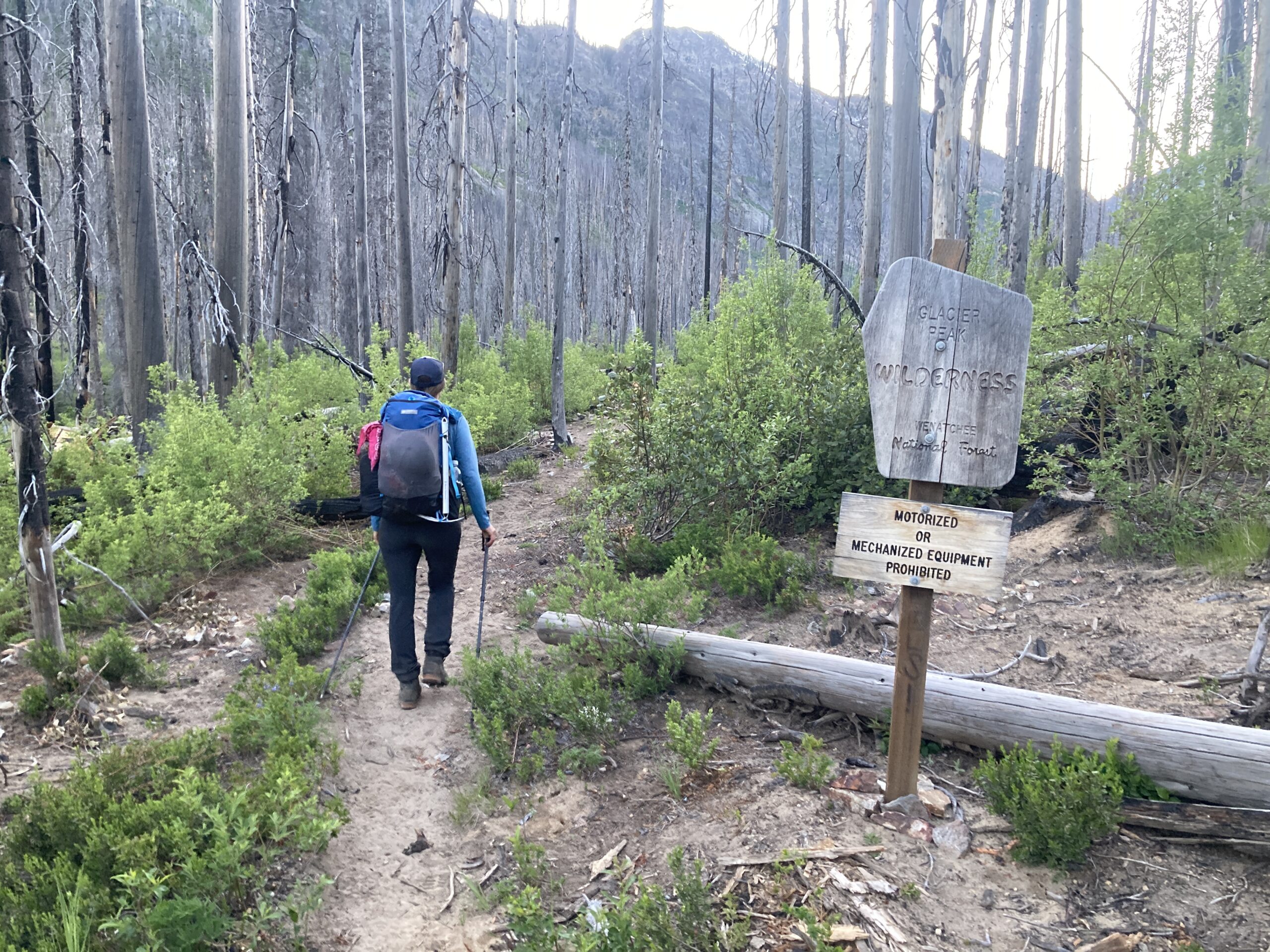
We began from the Entiat River Trailhead in the evening. Unfortunately much of this trail is burned, but it’s been cleared so smooth walking while you’re on it. We made it to the junction that heads up east towards Saska, noted the spot, and then turned west onto a side trail that led to a campsite in a clearing near the river. It was called “snow brushy meadows,” and was quite beautiful. We got there just as it got dark and set up camp. Jeff saw some eyes and thought it was a big cat, we got scared for a minute but then realized it was a deer. Phew! Off to a weird and wild start.
Day 2 – Cardinal & Emerald
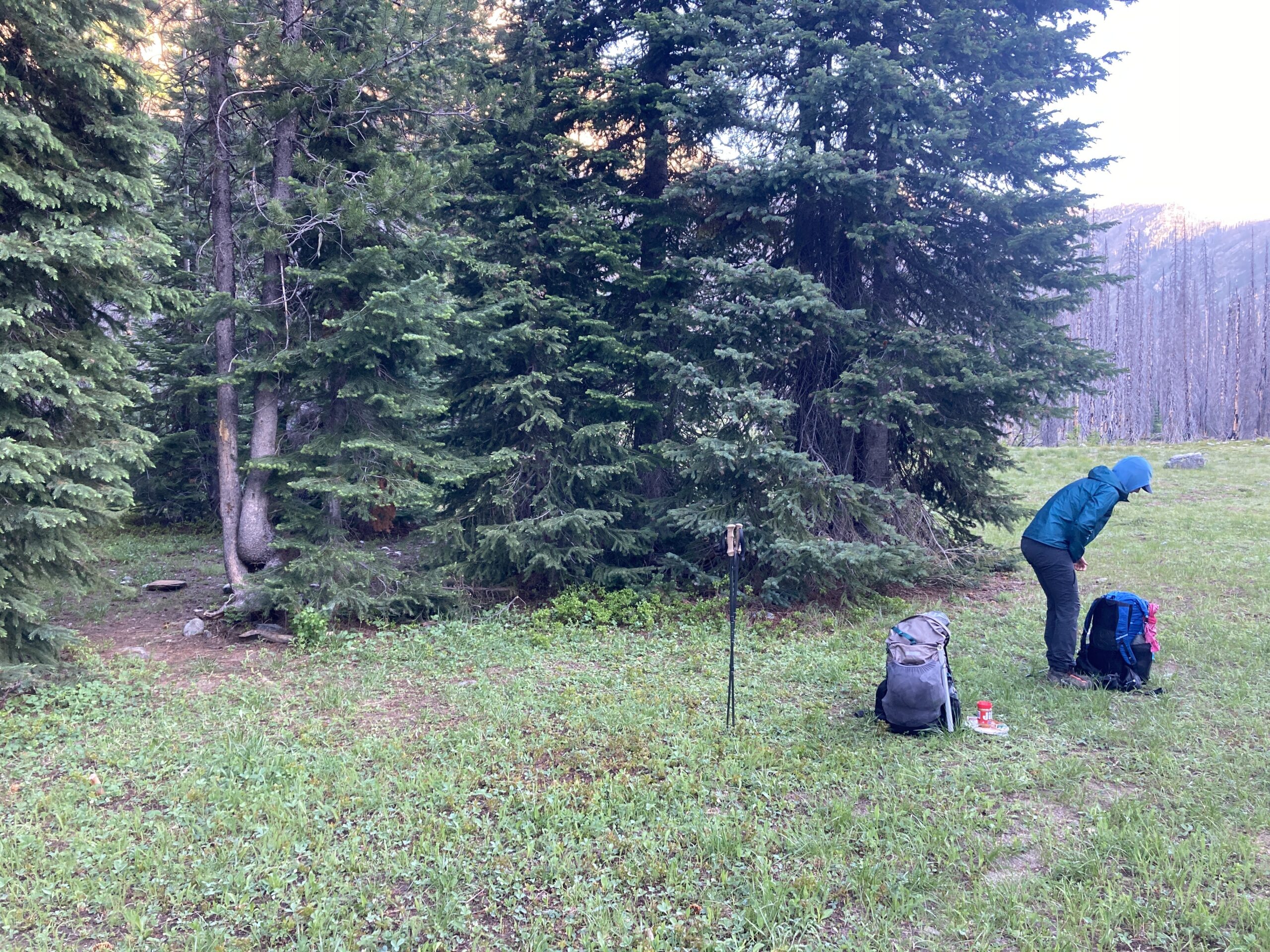
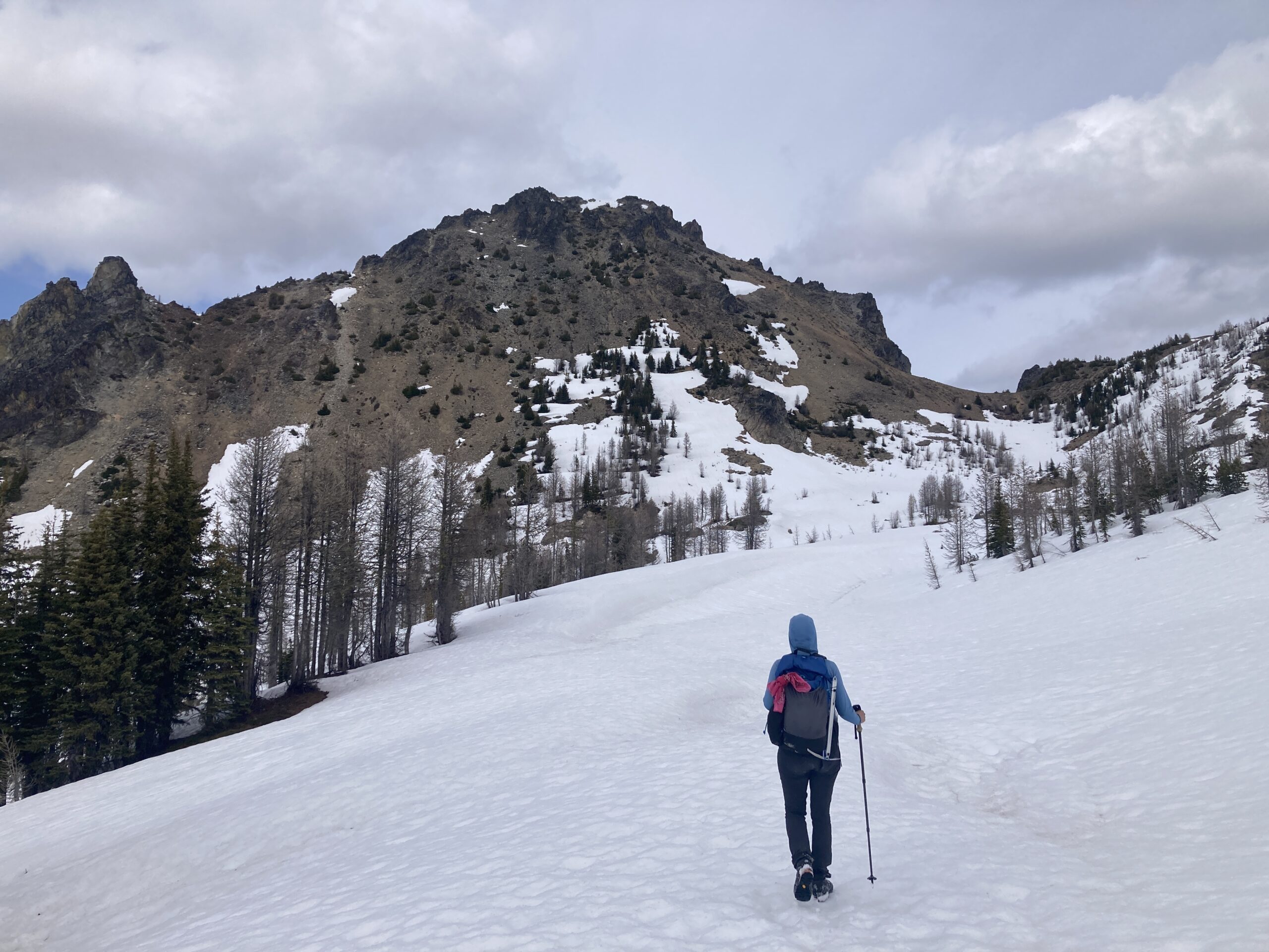
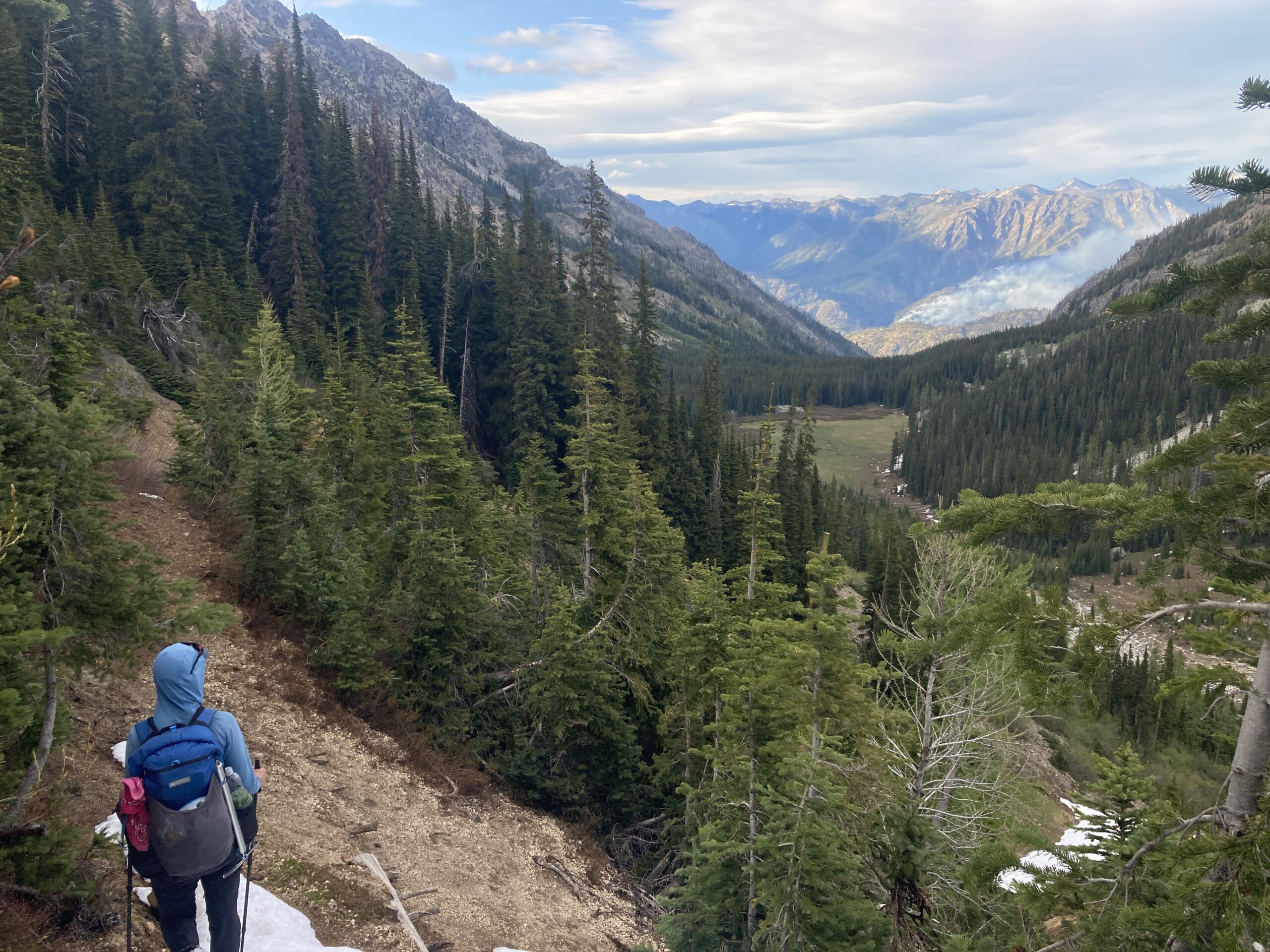
We began at 6:45 AM starting on the trail towards Cardinal and Emerald. The trail is good at first, climbing up. At 5,700 ish feet, we found a meadow clearing without dead trees near water, and set up a camp there to leave a few things and come back to that afternoon/evening. We then continued on with lighter packs towards our day’s objectives.
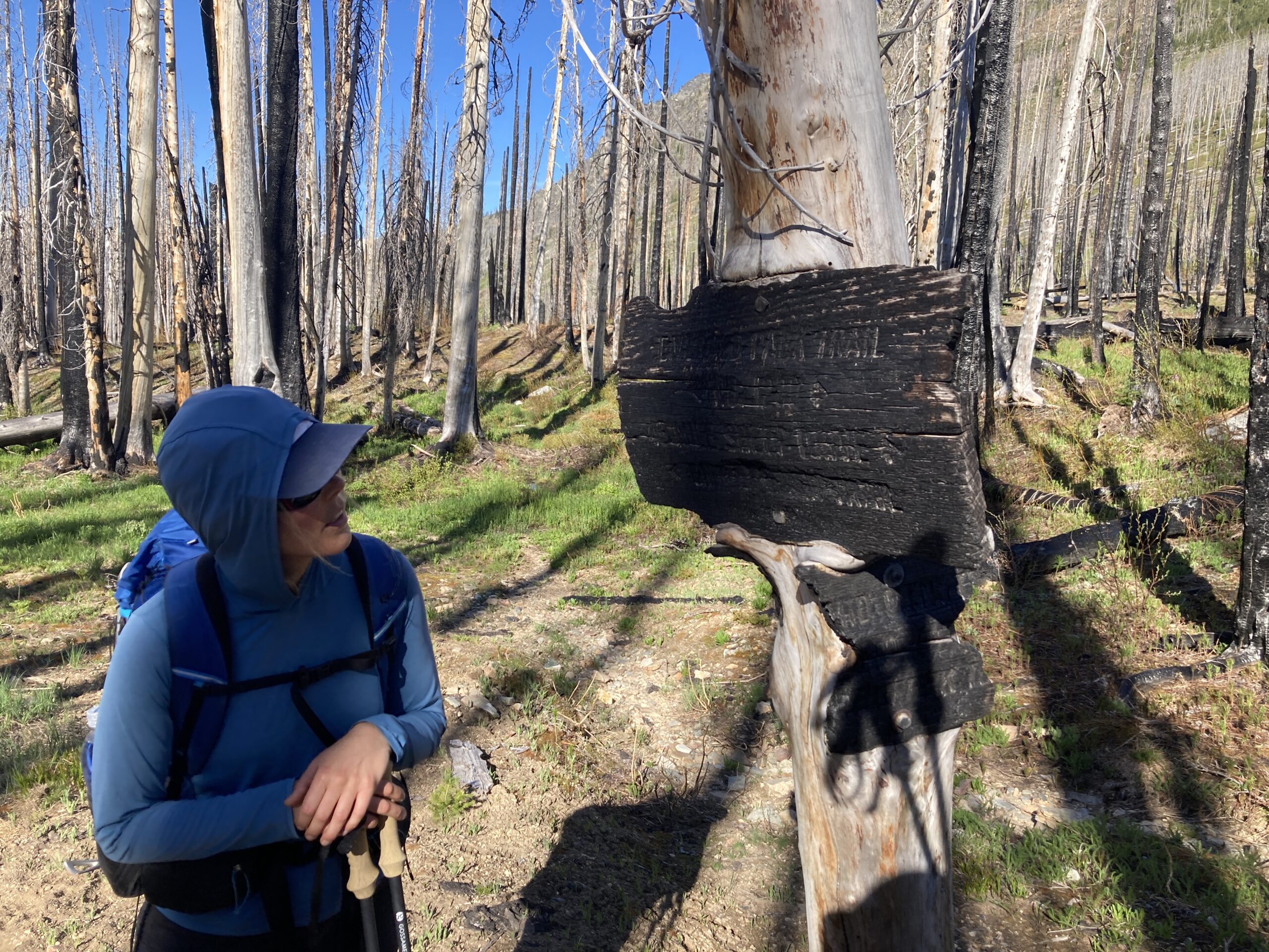
There is a burned up junction at 5,800 ft. Where you can just make out the charred trail sign. We turned east here and started heading up through brush, ash, dirt, occasional rock, and occasional snow. The travel was fine, but the trail is hard to stay on fully, so we mostly just picked our way upwards to Saska pass.
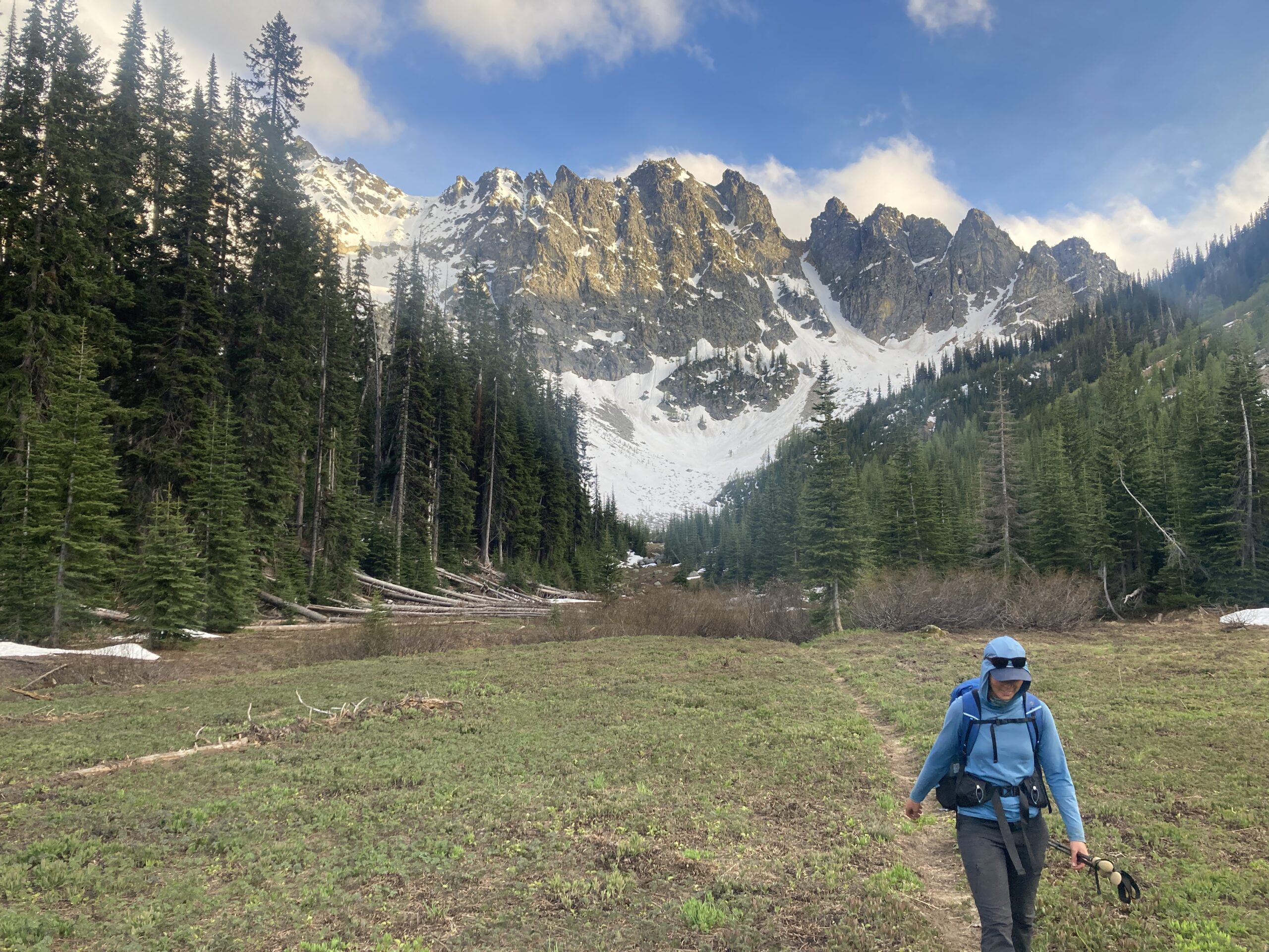
From the pass, the trail was covered in snow. This section of the Entiats is gorgeous and not burned. It made us wish we’d seen all of it before it burned so badly in places. From the pass, we descended on what seemed like it would have been the trail to 7,000 ft. then starated contouring there on what would have been the trail into the middle of a small basin. At about 6,800 feet we left the “trail” and headed in an easterly direction to the basin below the west side of Cardinal peak.
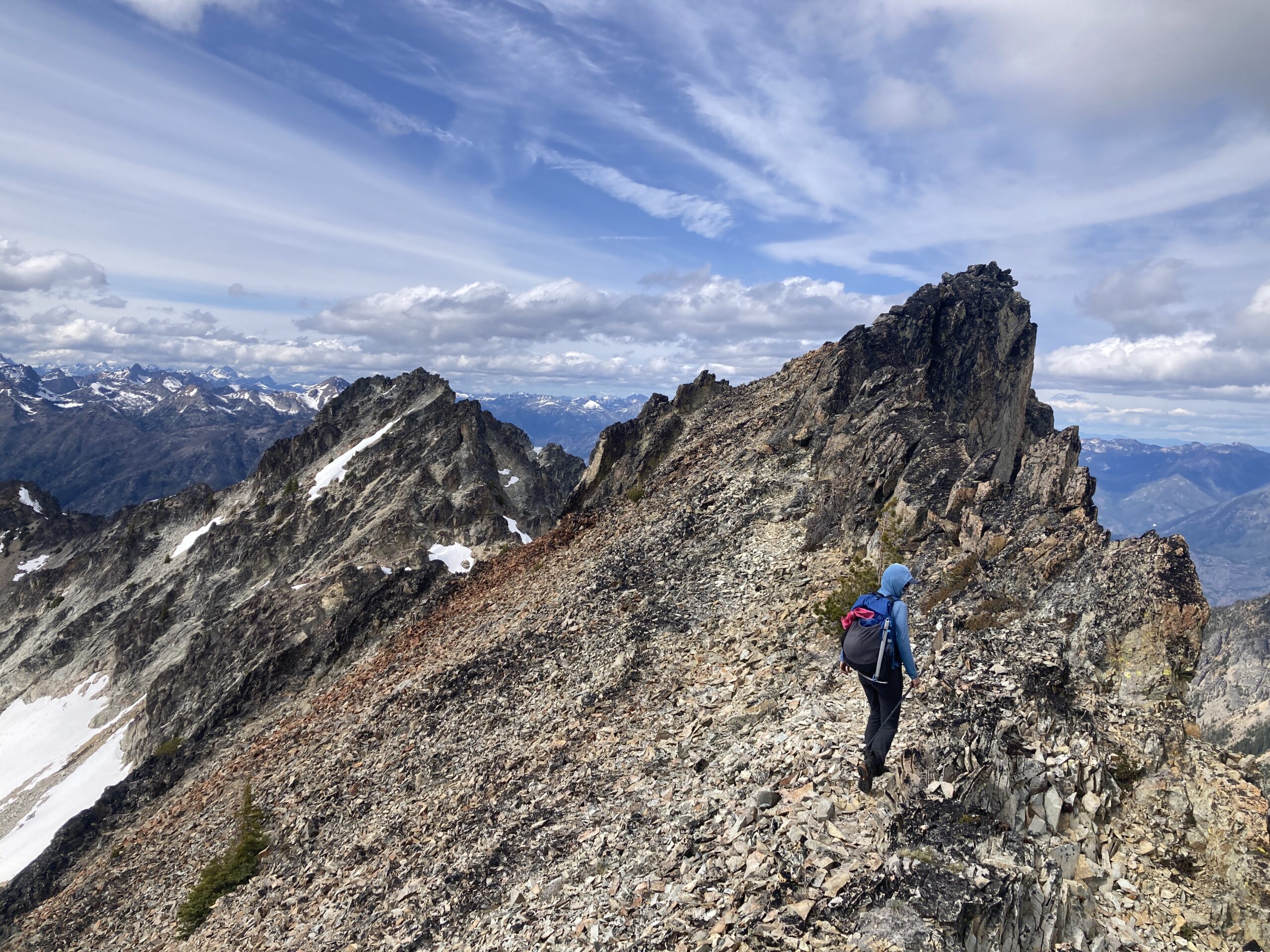
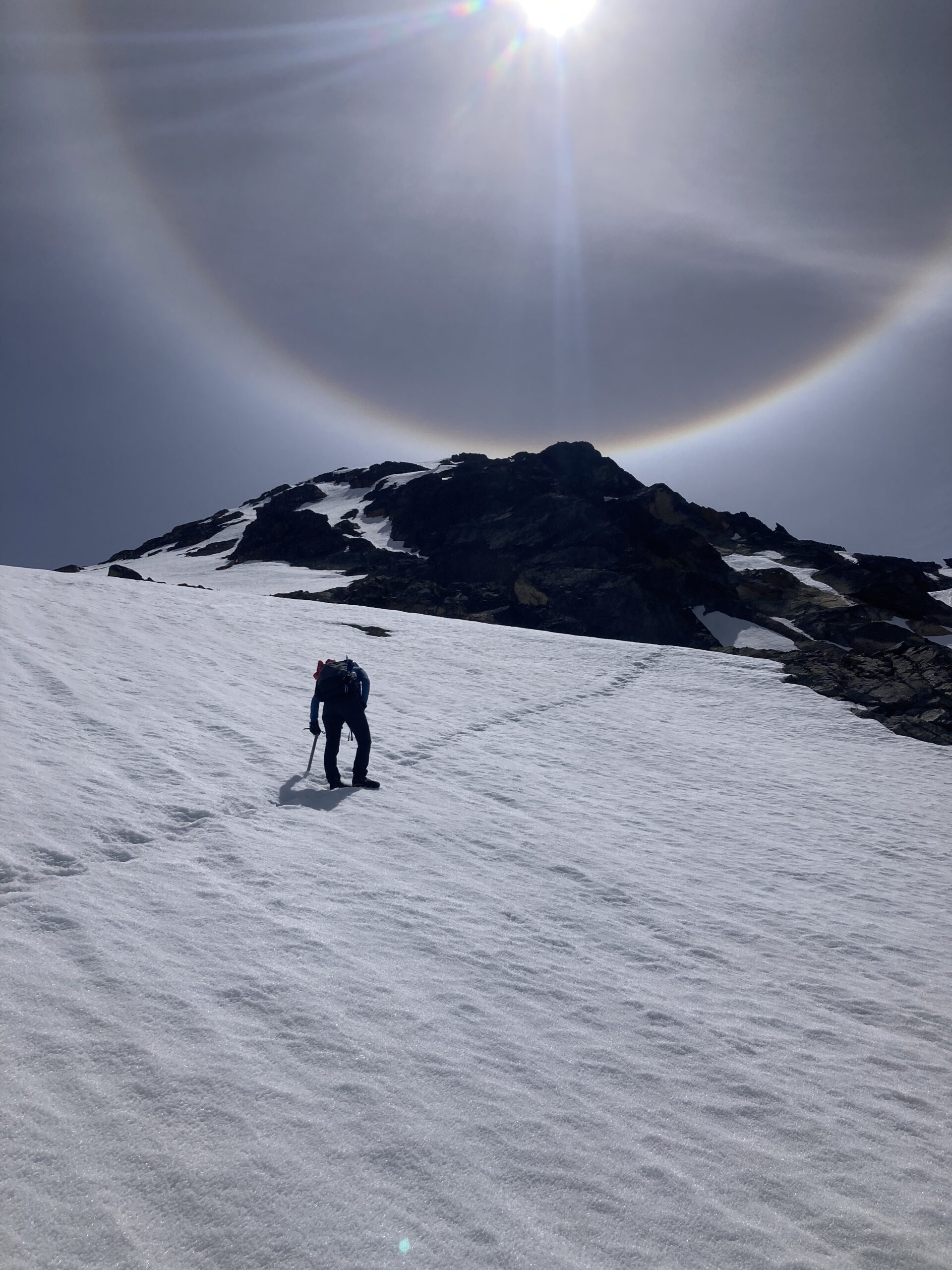
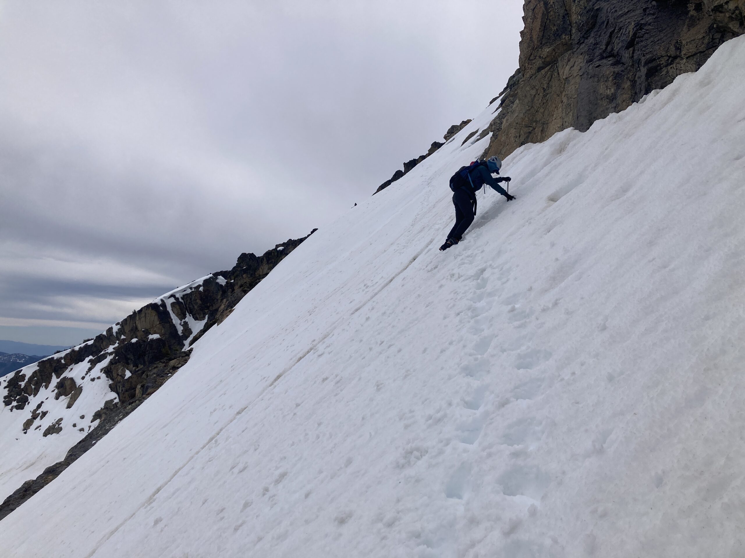
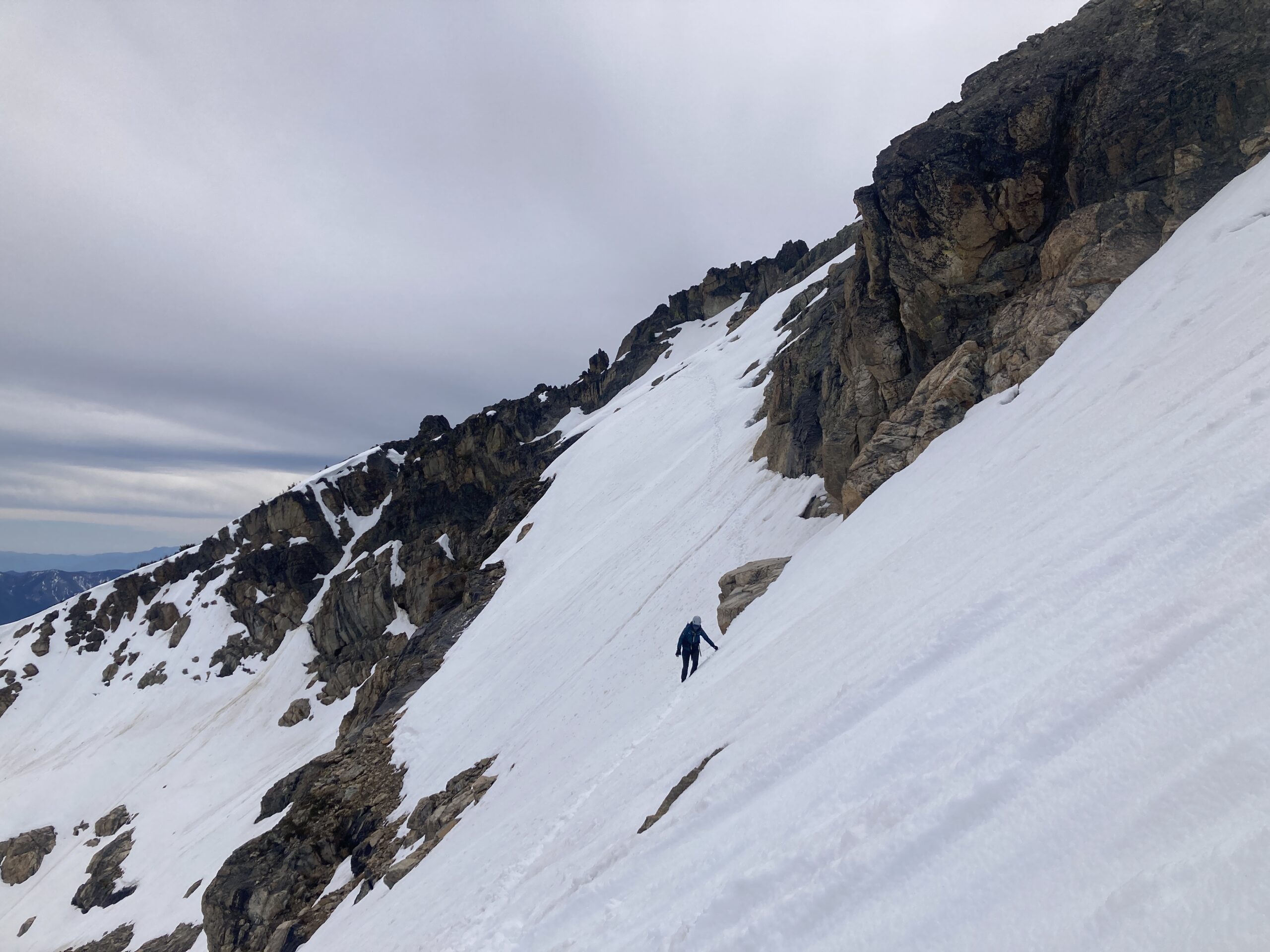
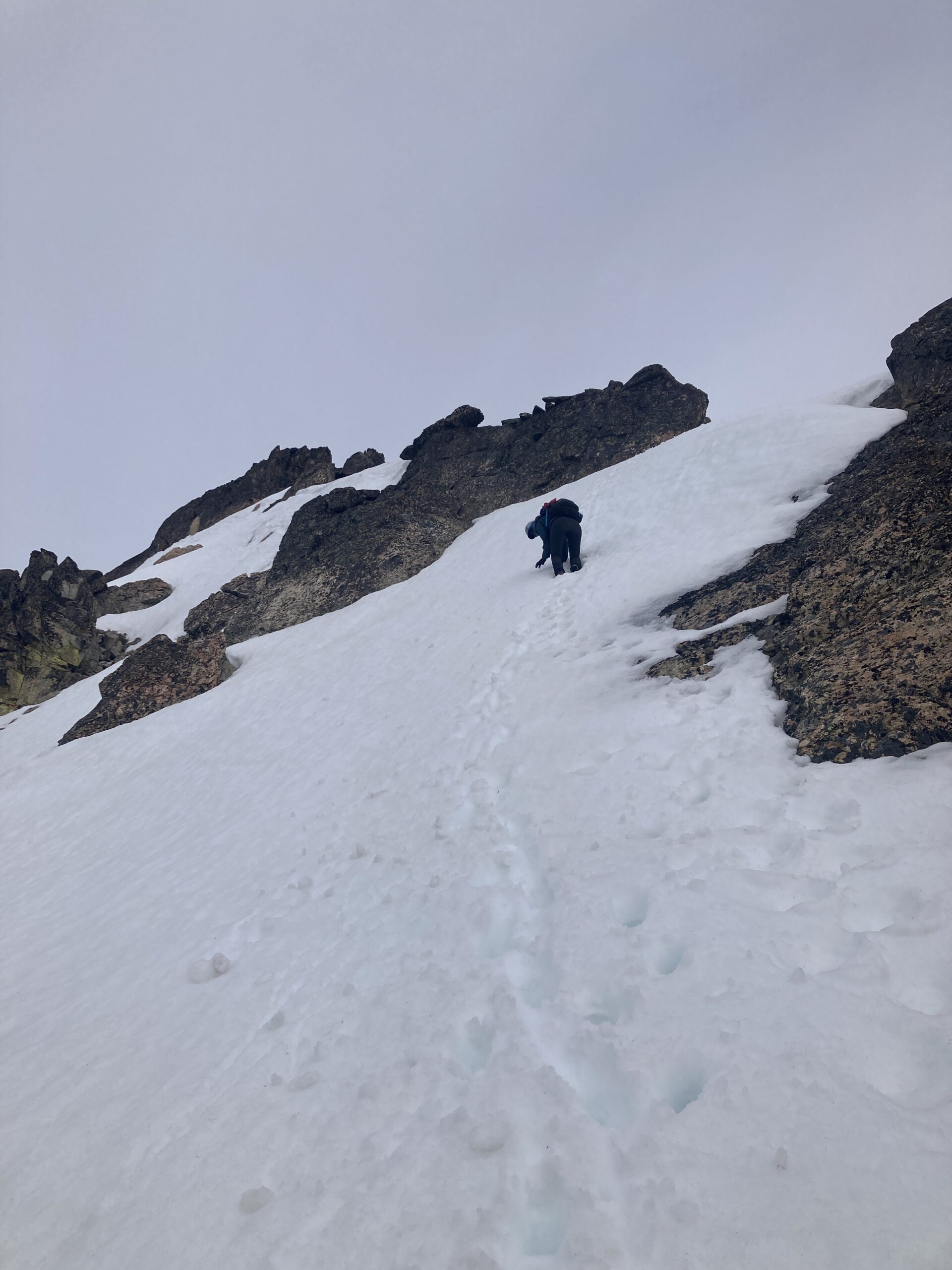
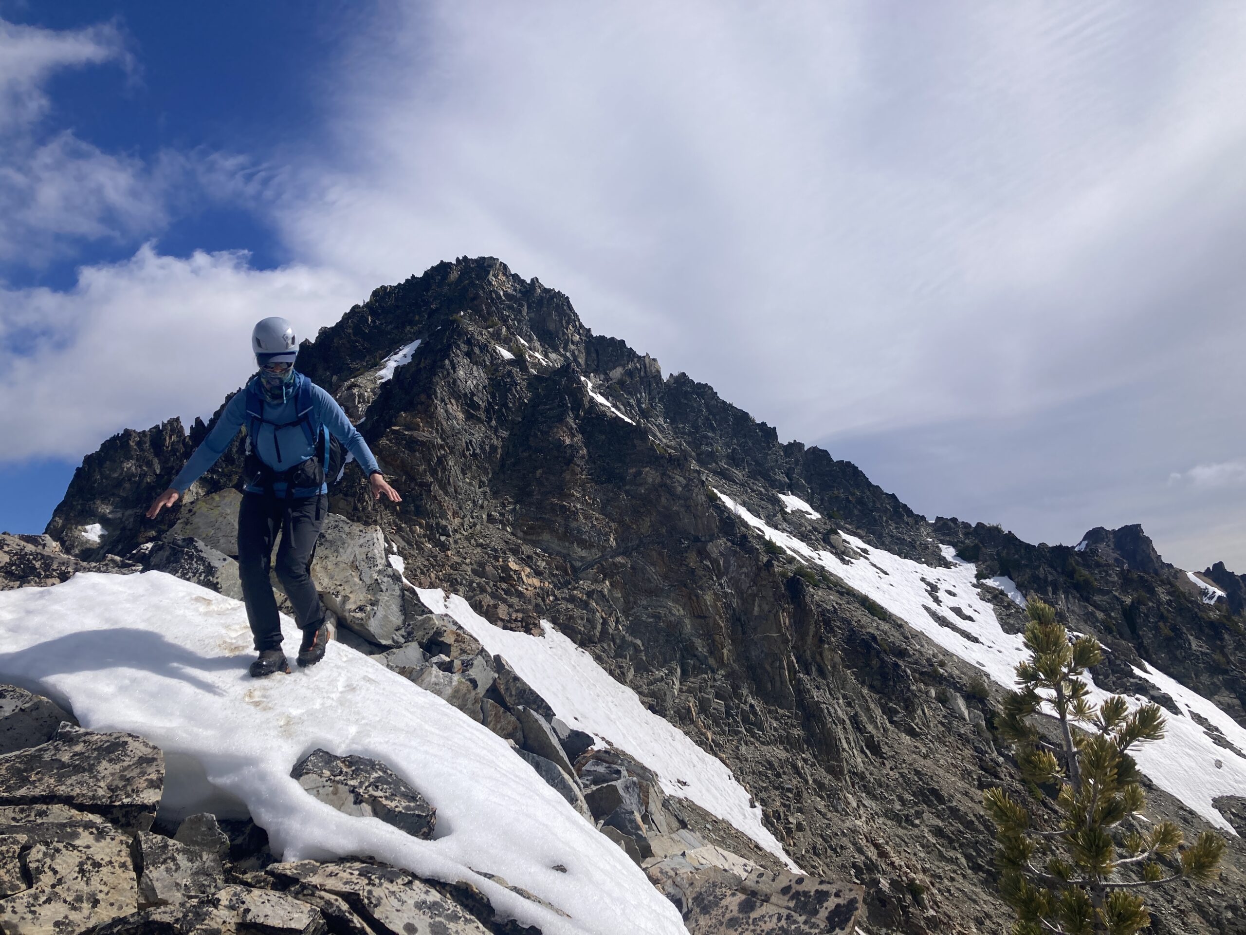
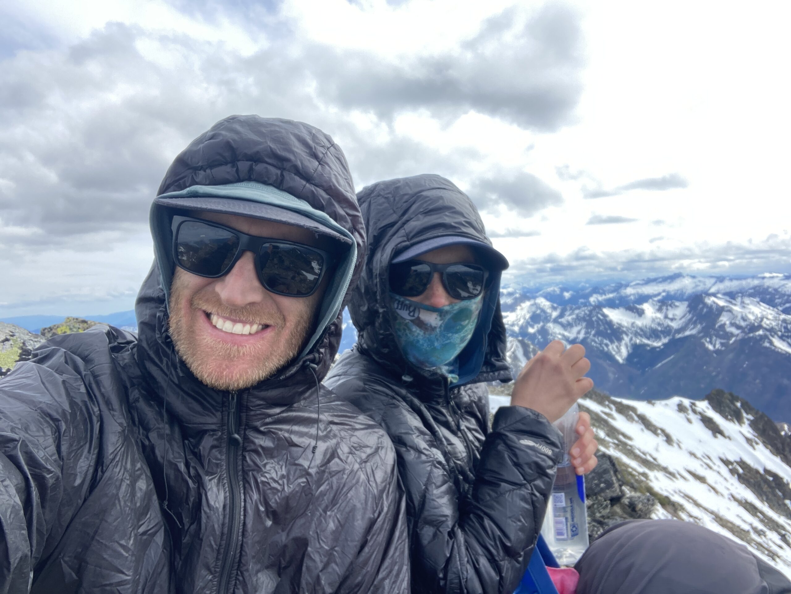
This began our snowy ascent to the ridgeline. We did long switchbacks ending at the saddle just northeast of the summit of Cardinal. From here we had some tricky decisions, scouting around both sides of the steep snow and rock on the ridge to get to the summit proper. We eventually chose a route just east of the Cardinal ridge, making our way across very steep and exposed snow. At the very end of this steep snow there is a small notch below a few moves of 5th class climbing to the summit. We brought a few cams and very thing cord (not rated for climbing! Not recommended but it was what we chose). Jeff led these moves to the summit. Fun and exposed! We then did a mini rappel doubling up our cord back to the notch. The steep exposed snow back was mentally taxing, but we made it without issue back to the saddle and then back down, retracing our steps to around 7,000 ft. in the basin below the Southwest side of Emerald peak, our next goal for that day.
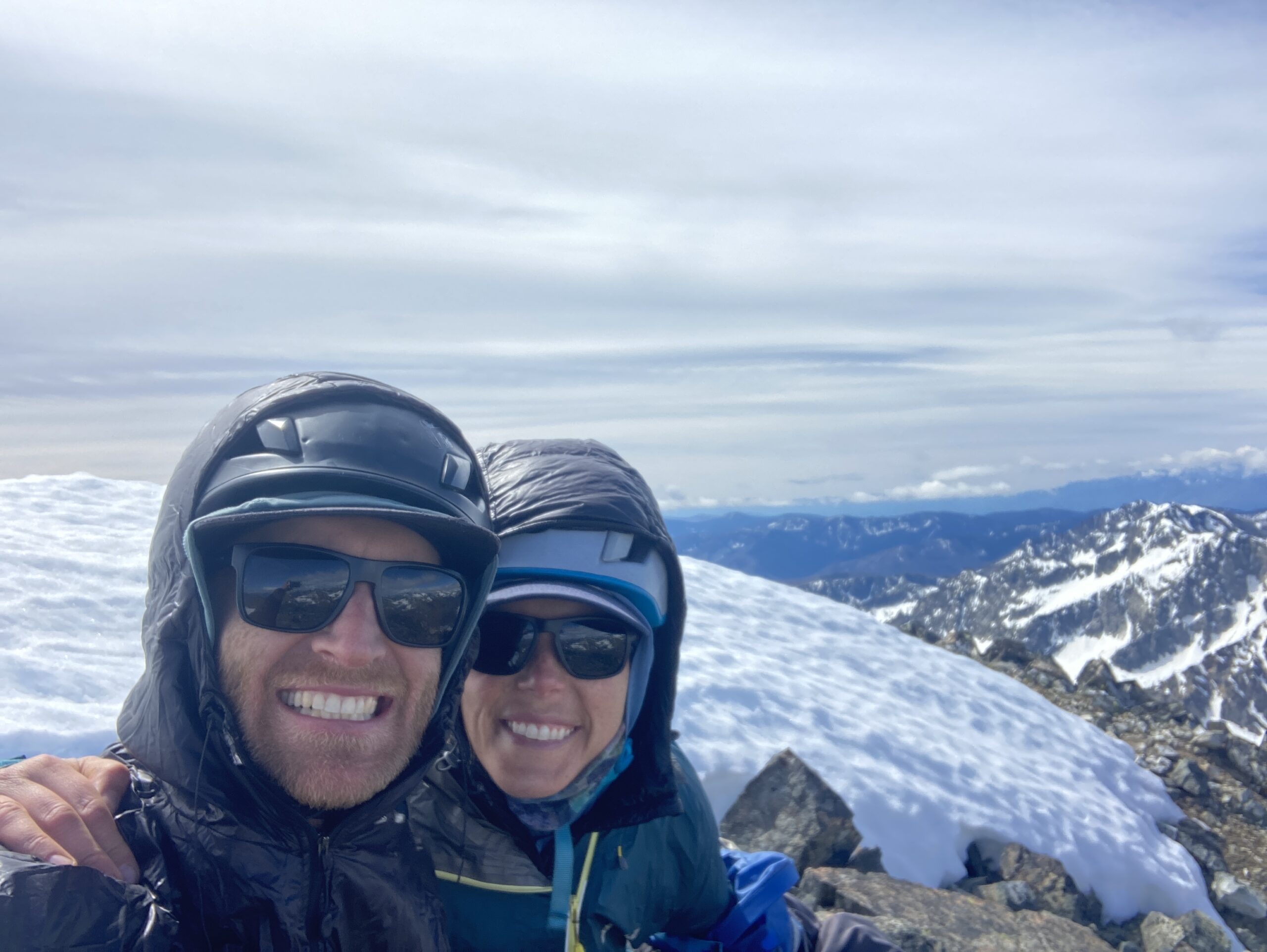
We headed essentially directly up this basin, staying on the mellowest terrain, which trends to the west side of the basin. Shy of the saddle/ridge, around 7,800 ft. we started heading towards the peak. At first we couldn’t tell which high point was the true summit. There is relatively steep snow gully to go up, with rocky outcroppings on both sides. We went east, then cut north, scrambling on rock to the top. This was a really nice way to end the day, and we were glad we had done the harder of the two peaks first! We were getting tired and still needed to make it to camp.
Reversing our route down, going a slightly different way on the way down, more west than we had come up, we found ourselves back in the basin below Emerald for the third time that day. We went back along the “trail” to the pass, staying higher than we had on the way out. From the pass we descended all the way back to our camp: Ending 13 and a half hours later, after 13.4 miles and 7,701 ft. of gain that day.
Day 3 – Saska & Pinnacle and hike to Emerald Park
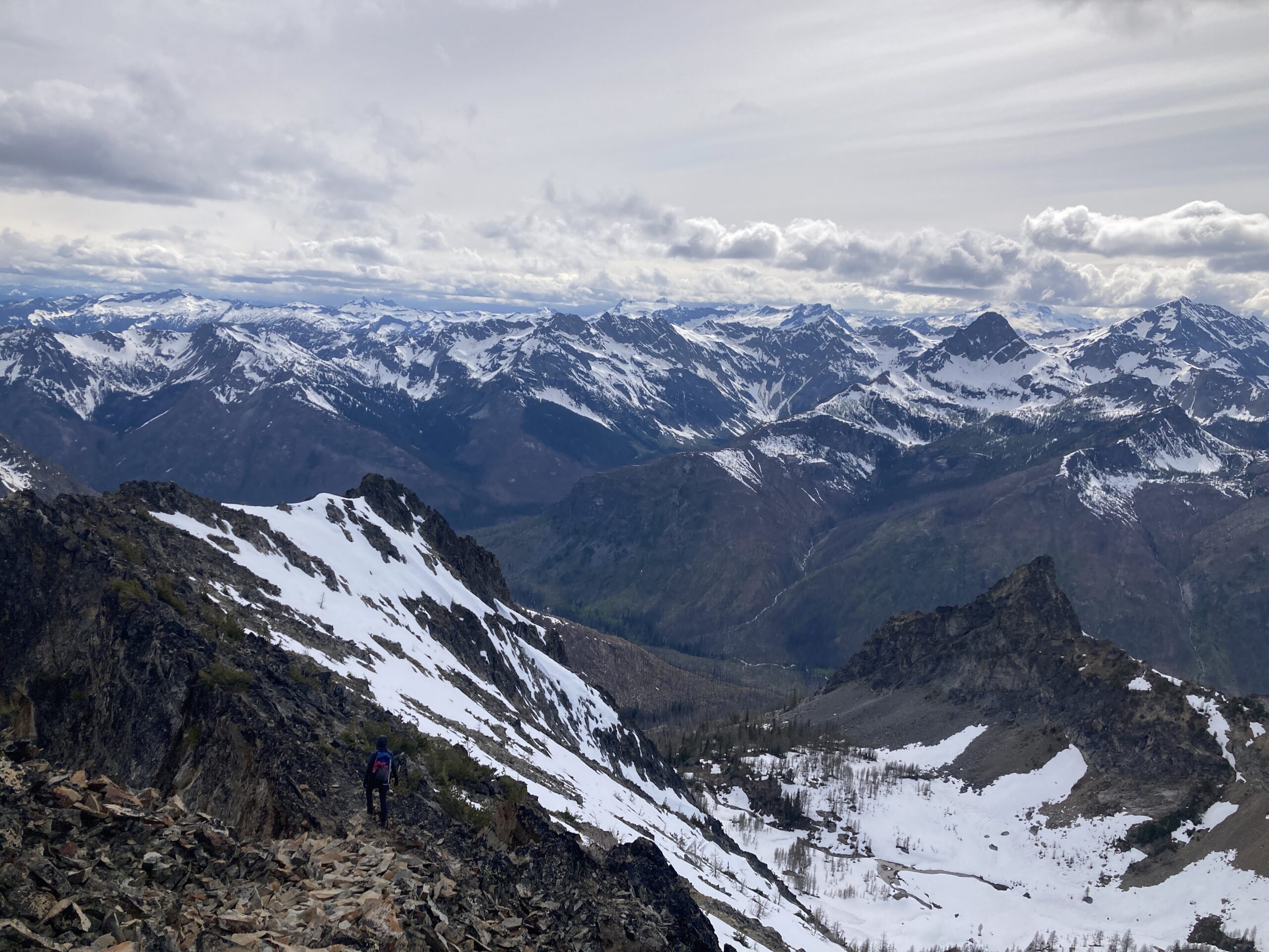
The next morning we started hiking at 7:40 AM – planning for Saska and Pinnacle. To start the day we had to retrace our steps over Saska pass. We dropped off the east side of the ridge for a bit then climbed back up to it staying on it directly for much of the way. We dropped to the east side near the end before scrambling to the summit. On the way back we dropped down farther on the east side and then back to the pass.
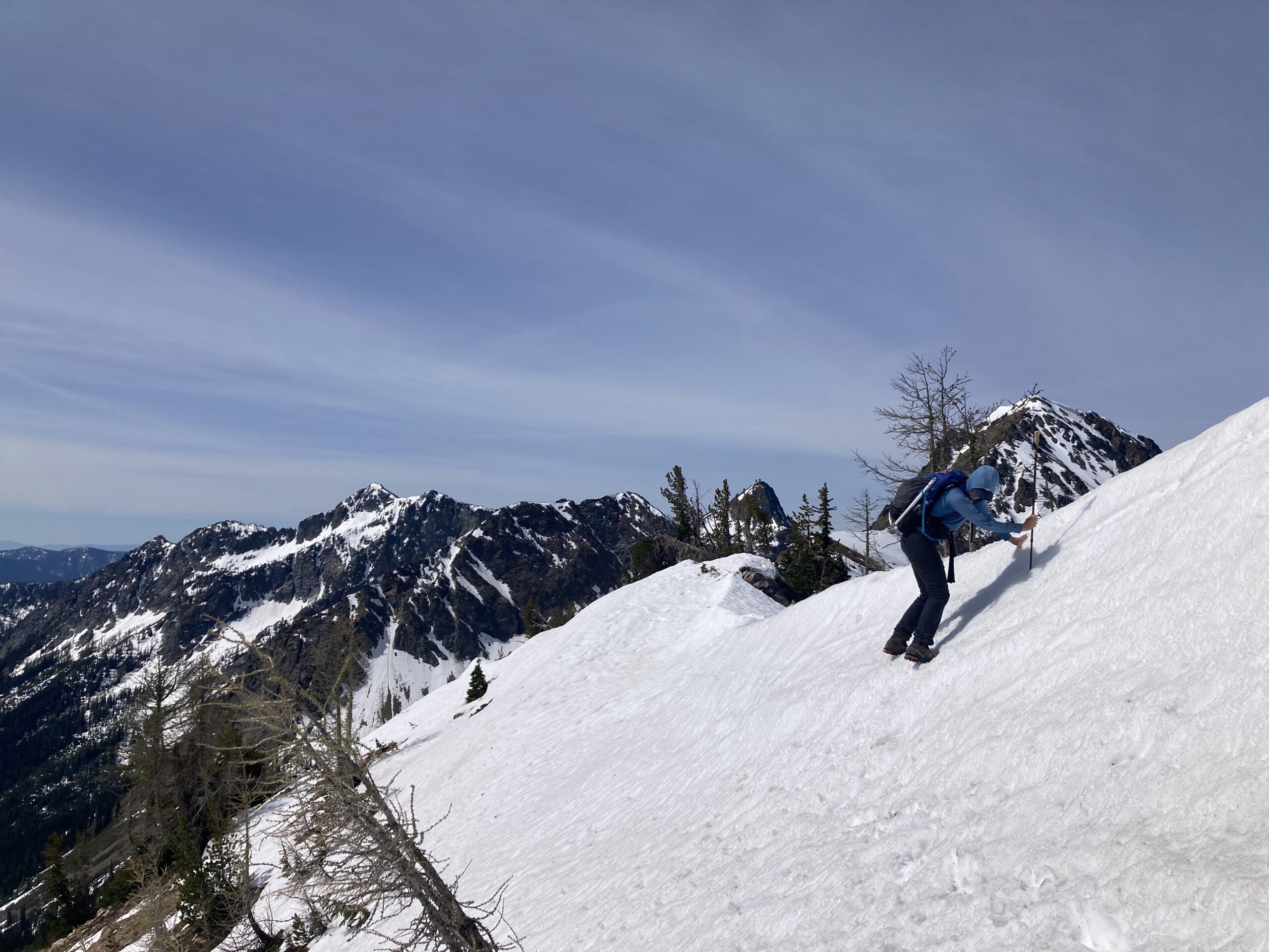
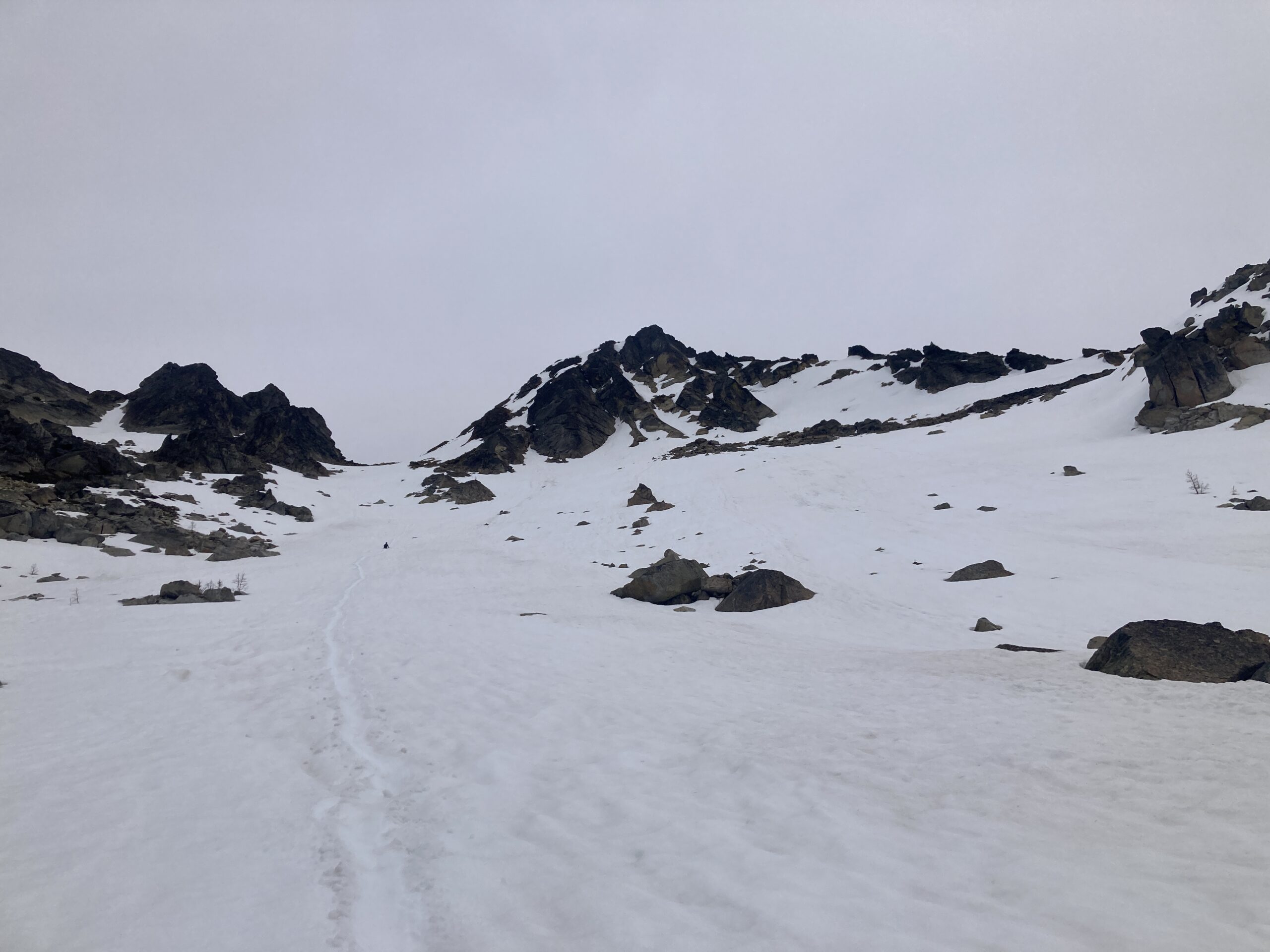
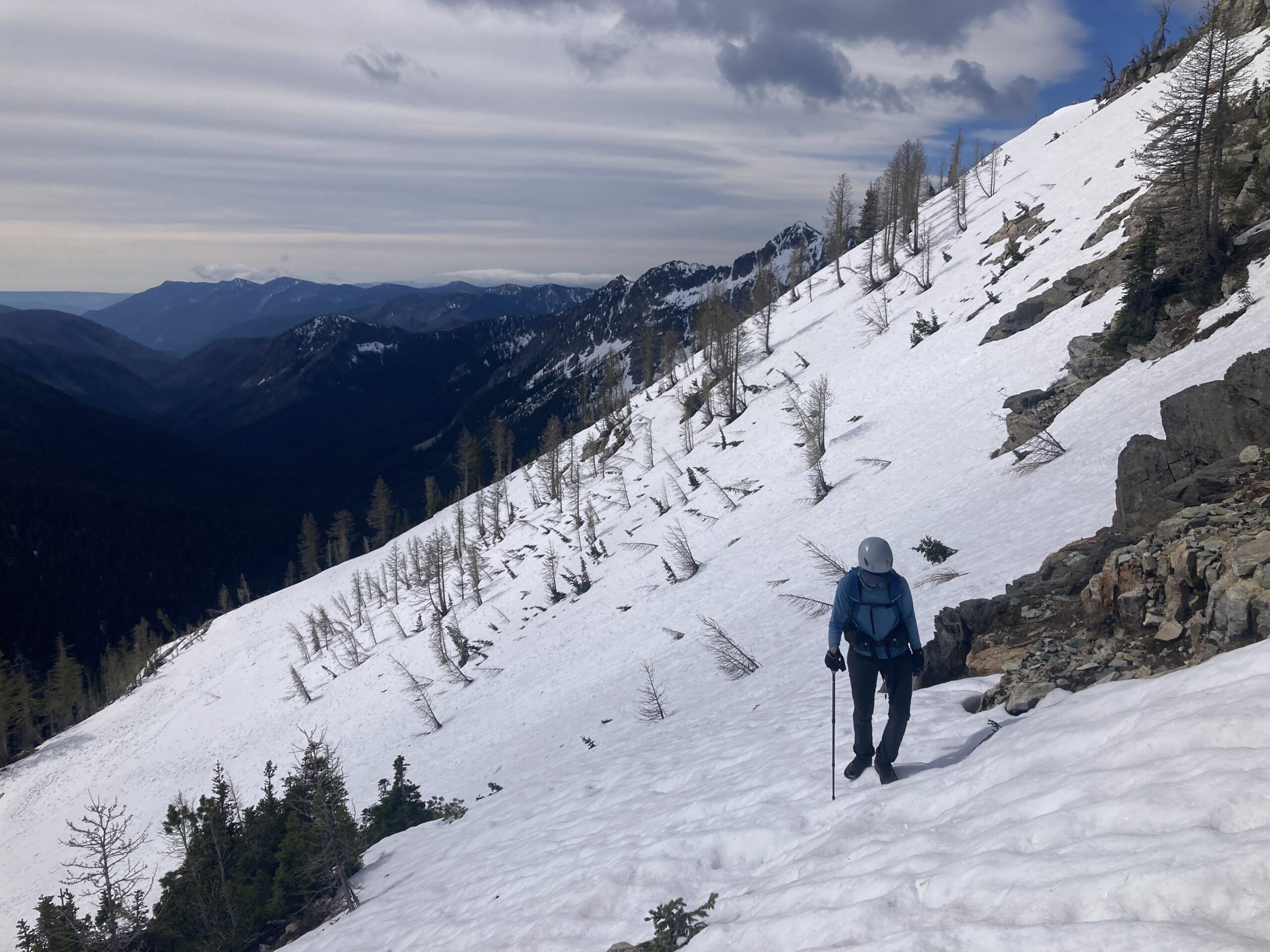
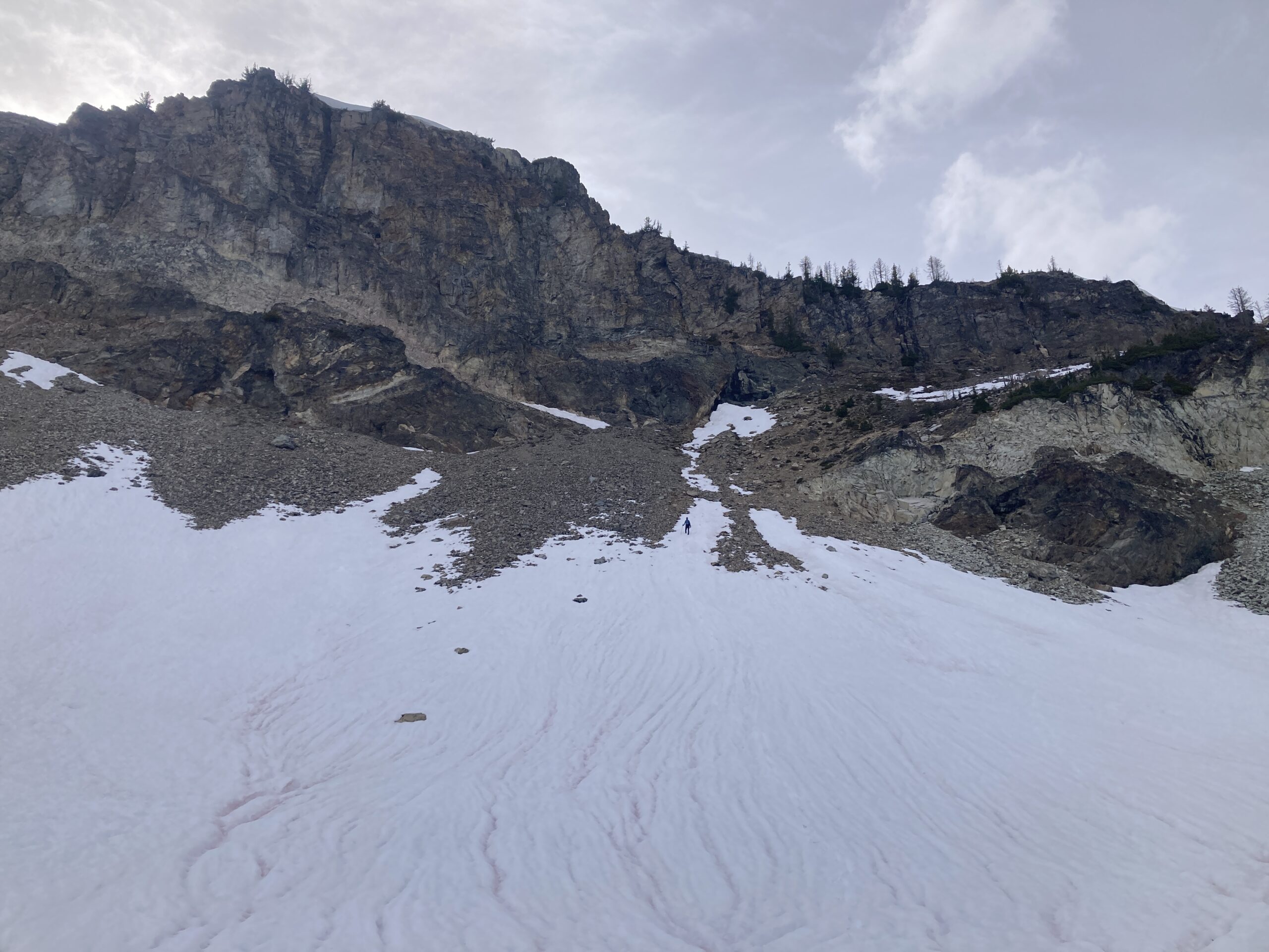
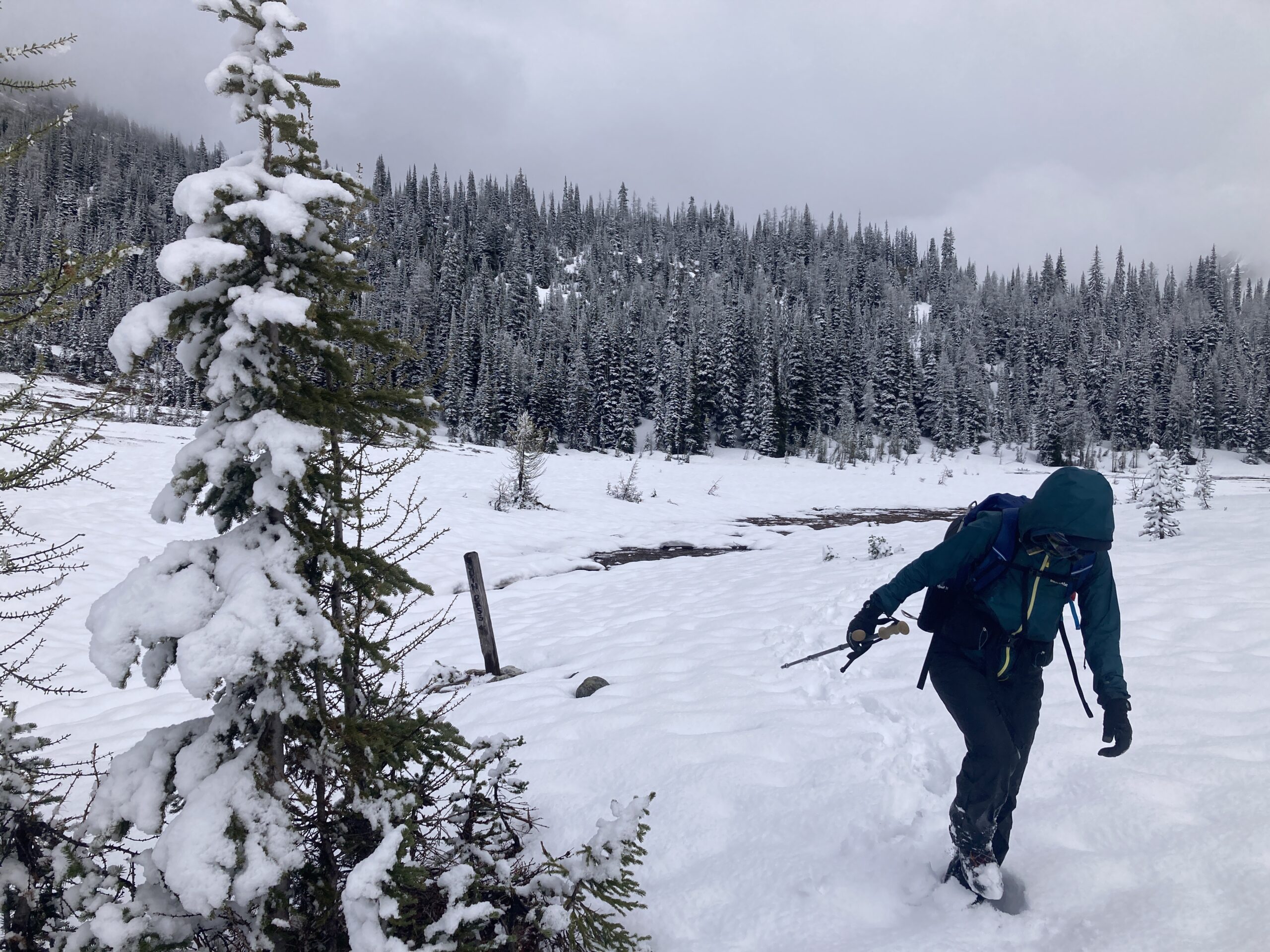
Once back at our campsite we ate some food, and packed up to continue on towards Pinnacle. This was a very long peak, but not technically very challenging. We hiked to the trail junction that heads west up to borealis pass. We dropped some of our stuff here, stashed under a log, and took lighter packs out to Pinnacle. The trail was in and out as we ascended, but we managed to stay near it, finding it periodically. Once you get through the burn (down trees to navigate) the area is beautiful, park like and full of steams and interesting cliffs. There was lots of snow so we mostly traveled on snow near the pass and beyond it. We headed to the West side of a bulge on the ridge above the pass, and contoured around this to a very flat zone around 7,600 ft. From there it was a steady scree slog uphill on snow, and red shale to the top.
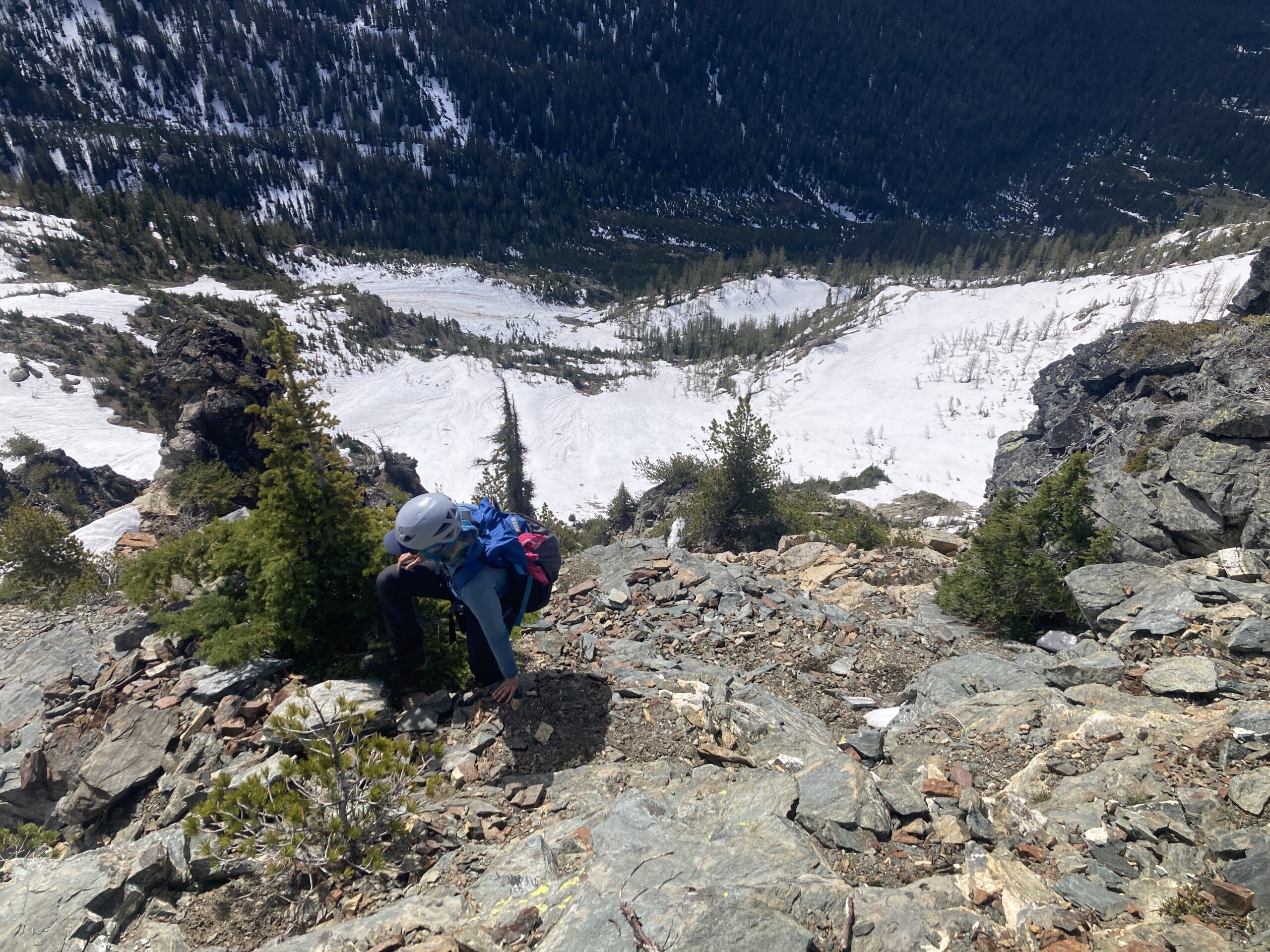
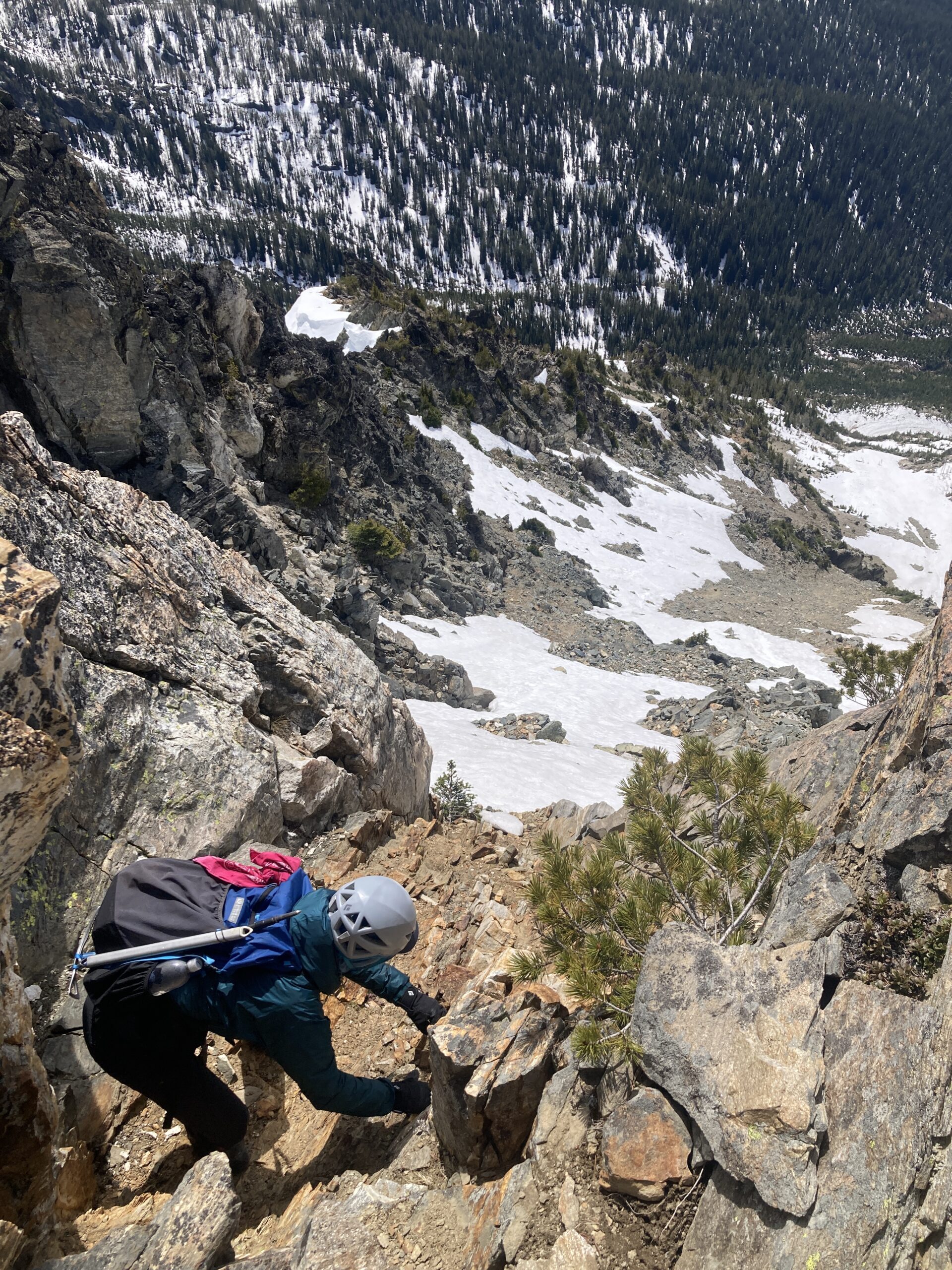
On the way down, we wanted to avoid going all the way back around to Borealis Pass, so we picked our way carefully across a few waterfalls and steeper zones in the basin south of Pinnacle. This way is much more direct, but didn’t look that good on the way up. It seemed okay for the way down, especially after crossing a few icy spots, it mellows out considerably as you descend. We rejoined the ‘trail’ back to the junction with our gear, and packed up again, heading north on the trail to Milham Pass.
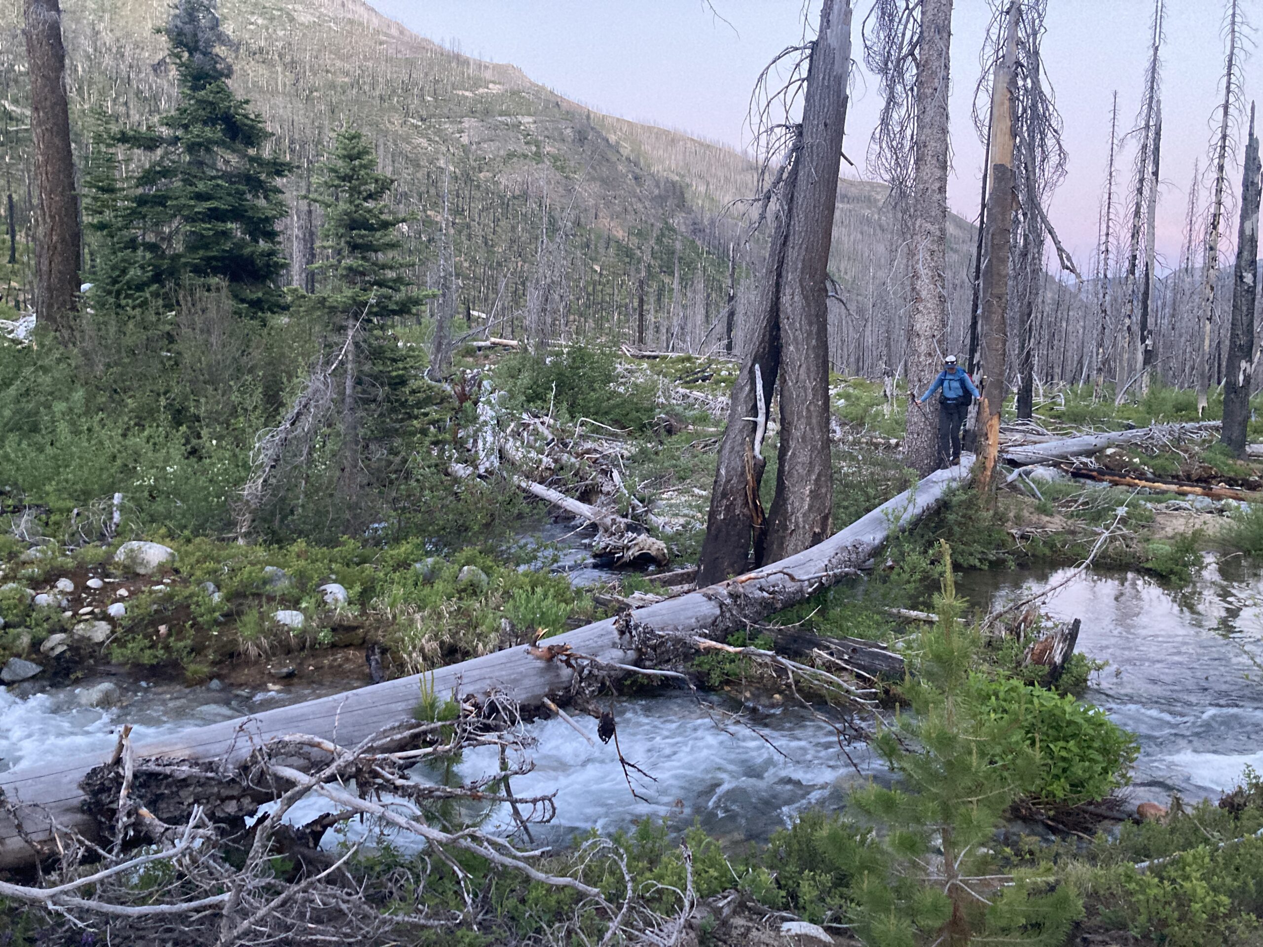
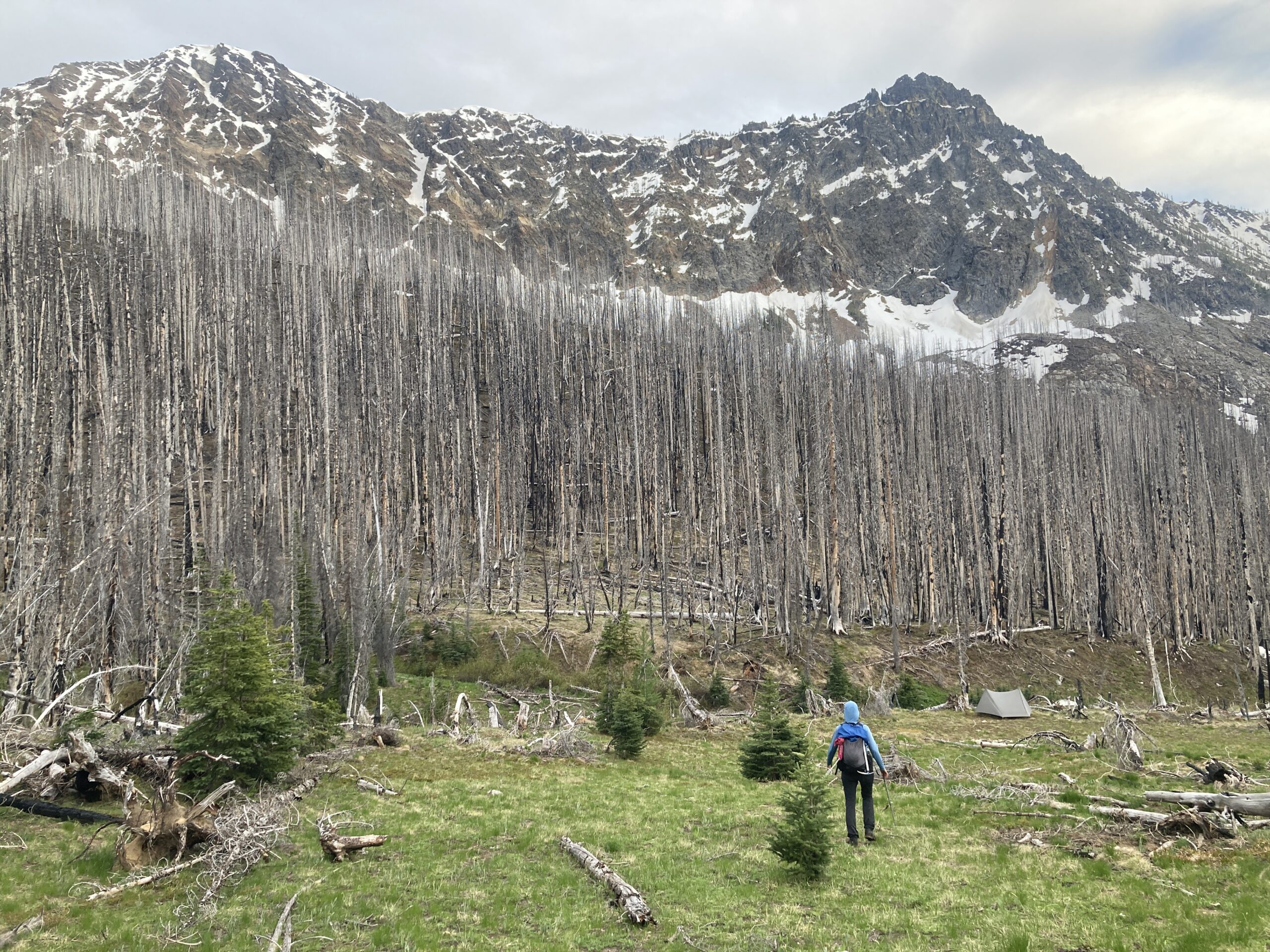
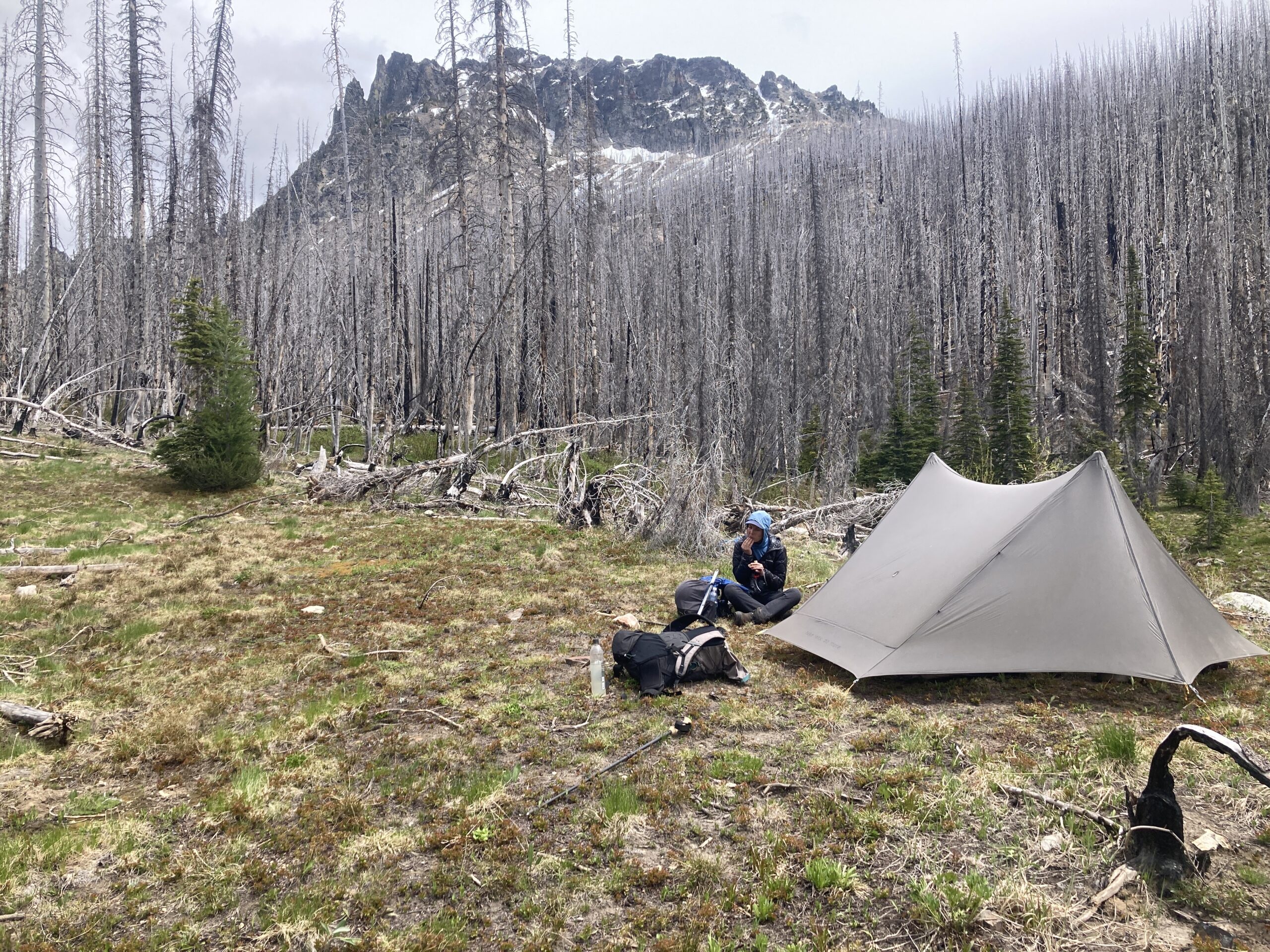
The other side of Milham looks very different than all the terrain we had seen thus far. The trail was covered in snow but we made our way down it along emerald park creek. When the trail flattens in a wide meadow you are met with an insanely beautiful view. Emerald Park is aptly named, like a gem amidst burned basins around it, it is alive, and felt like it was glowing as we walked into the evening light, finally found a good campsite at the meadow’s end, set up and went to sleep. We arrived there 12.24 hours and 11 miles and 5,858 ft. of gain later.
Day 4 – Hike to Lucerne
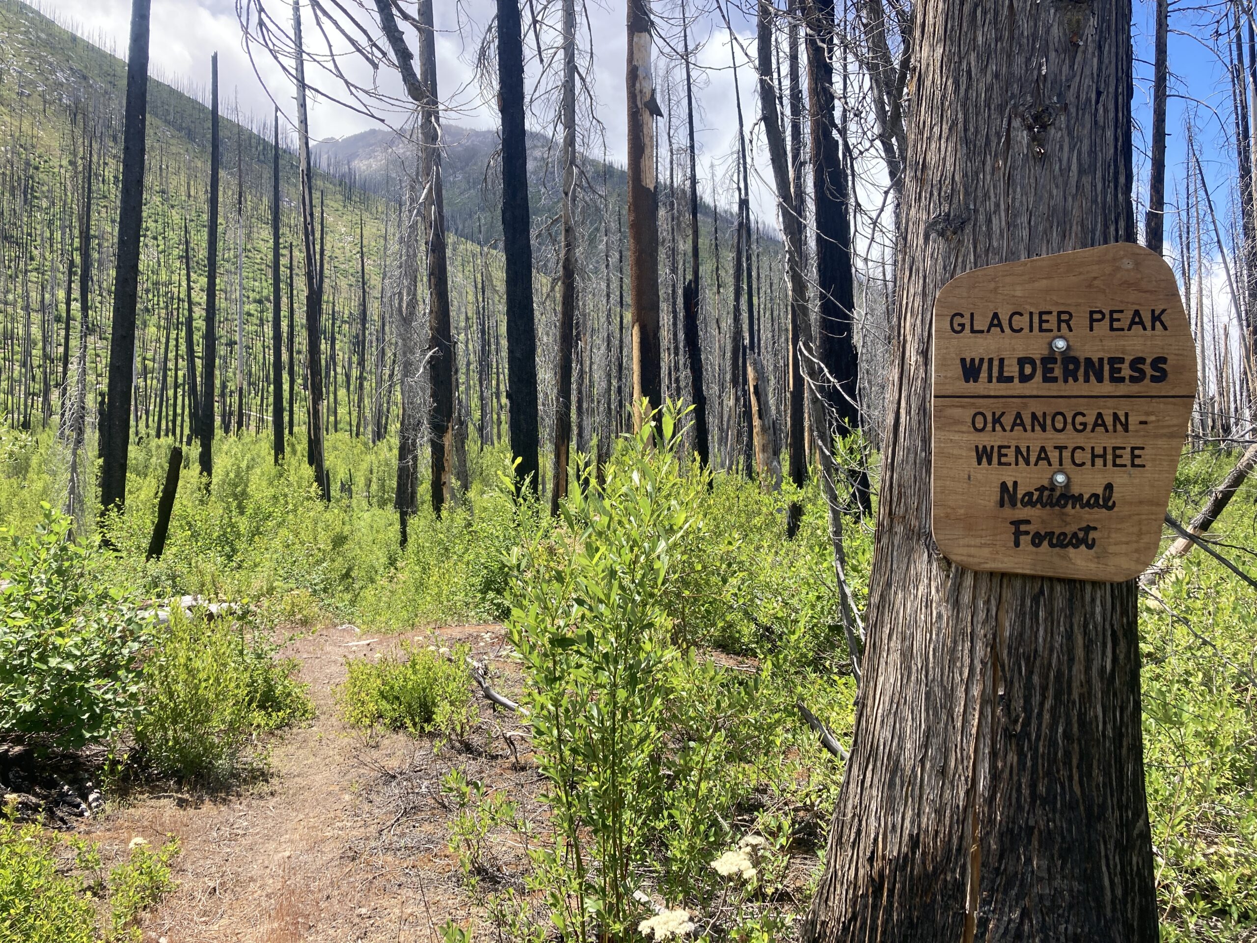
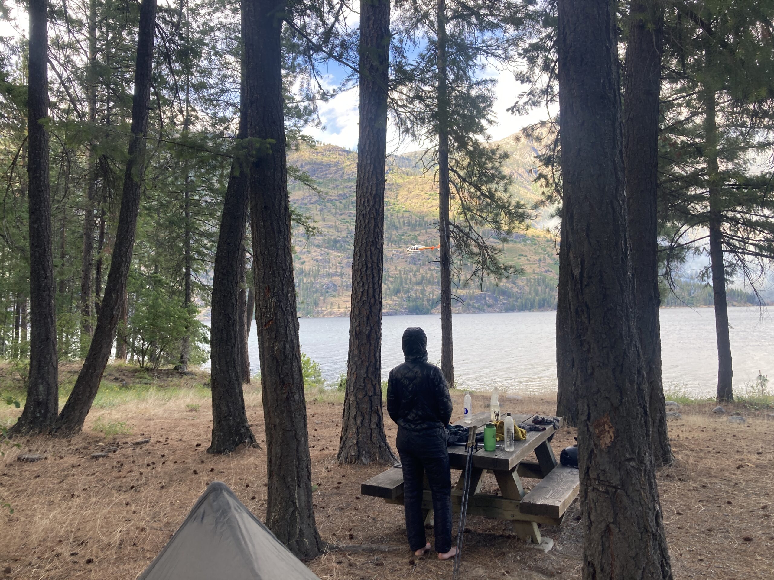
At a leisurely 9:30 AM we started hiking down towards Holden Village. We thought we would hike there, and then decide what our next moves would be. The trail is good for awhile but becomes hard to follow as you descend due to the old burn. At about 3,600 ft. we lost it completely and epic downhill over downed trees and brush. We dropped too low, and struggled towards what we thought might be the junction with the trail towards Holden. We eventually found the old trail again near the junction, and walked back and forth several times without ever seeing the trail that used to head to Holden Village from there. After debating for awhile about what to do – very hot at this point in the day due to the exposure from the burn, we decided to hike down to Lucerne below, and at least get close to water and make a plan for the following day. Our original plan had been to hike back out the way we had come in. But given how badly burned so much of the area was, and how far down we had descended over the past day and a half, that idea seemed less and less appealing with each passing hour.
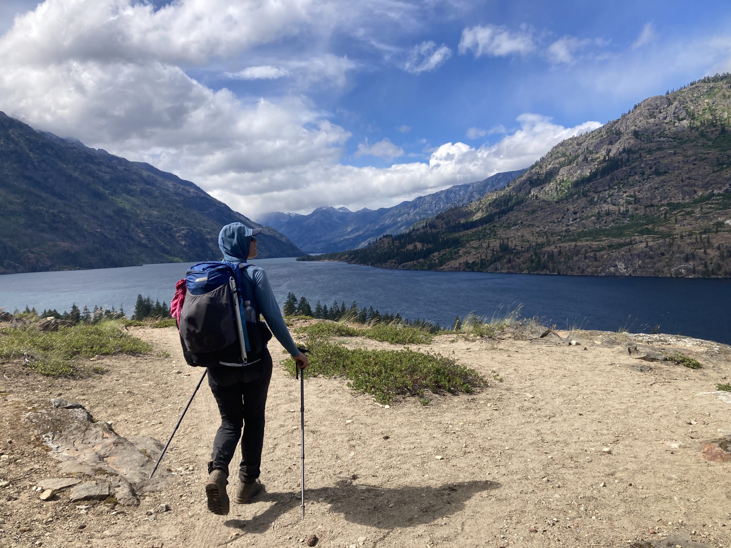
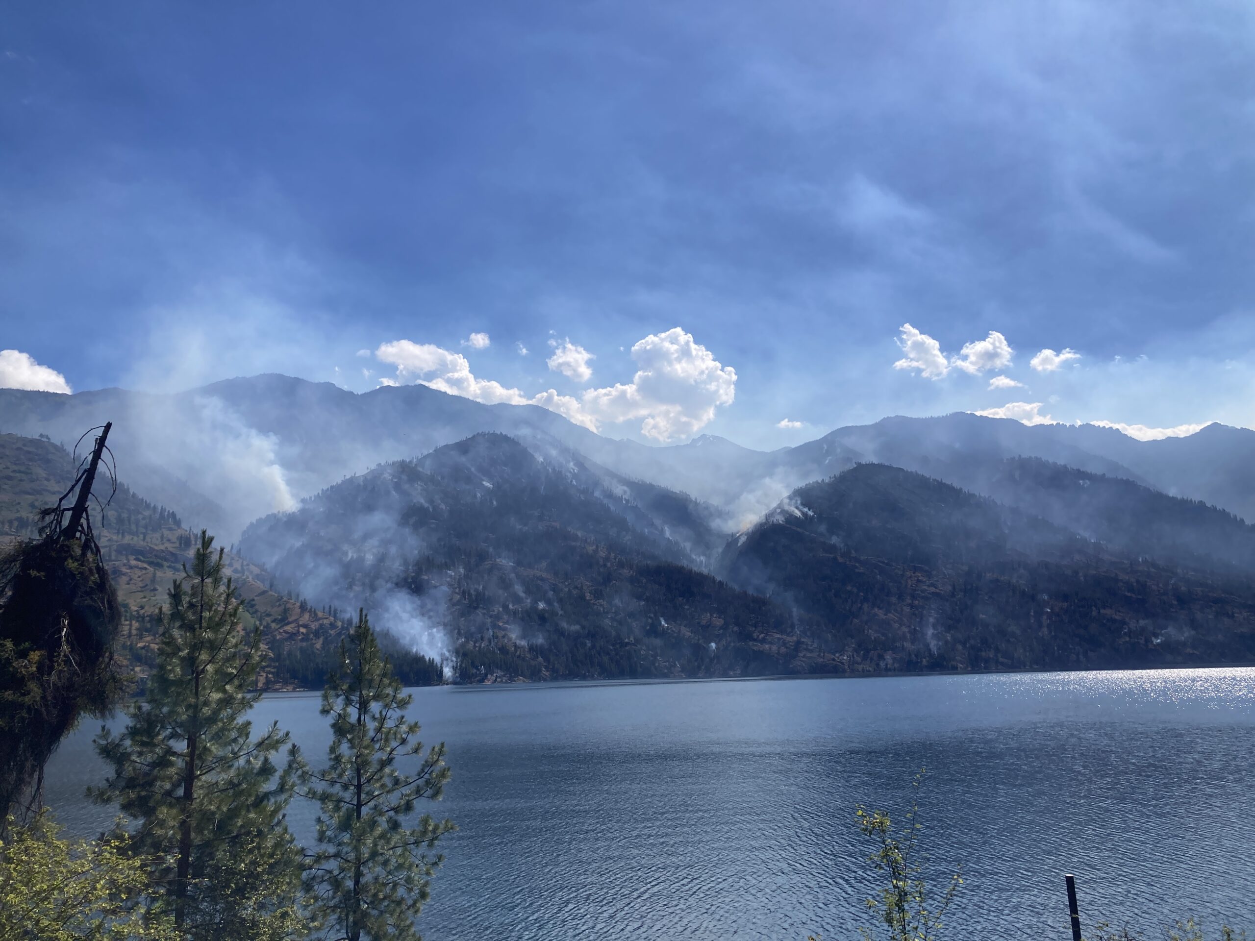
Once we made our way down towards Lucerne we immediately realized something was up. We had seen a little smoke the day prior, close to Stehekin and small, and assumed it was a controlled burn in the area of some kind. As we got to Lucerne we realized that a full fire crew was there, setting up shop. There is a caretaker house there. They found us walking through the area and stopped us to chat. They explained that the fire had started on the opposite side of the Lake, and that it had jumped multiple gullies in just a day or so. It did not look good. After chatting with a few folks from the fire crews, the caretaker showed us to a campsite at Refrigerator Harbor which was a beautiful and peaceful spot on the Lake. The caretaker explained that we could catch the water taxi the following day and pay on board if we went to the dock at the right time and waved the flag! When we realized this was possible, we decided to hike back to our house essentially, and go get our car at the Entiat River Trailhead another day. What a fun adventure!
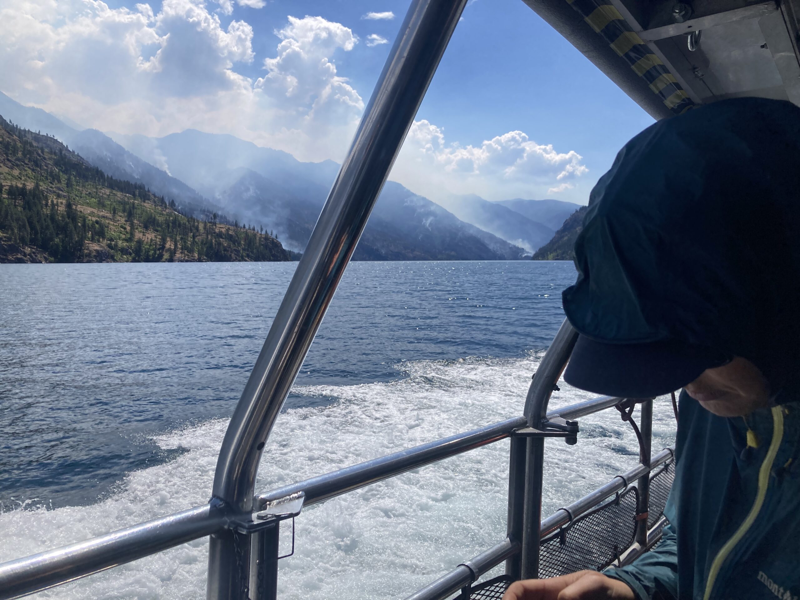
Day 5 – Stehekin to Fireweed
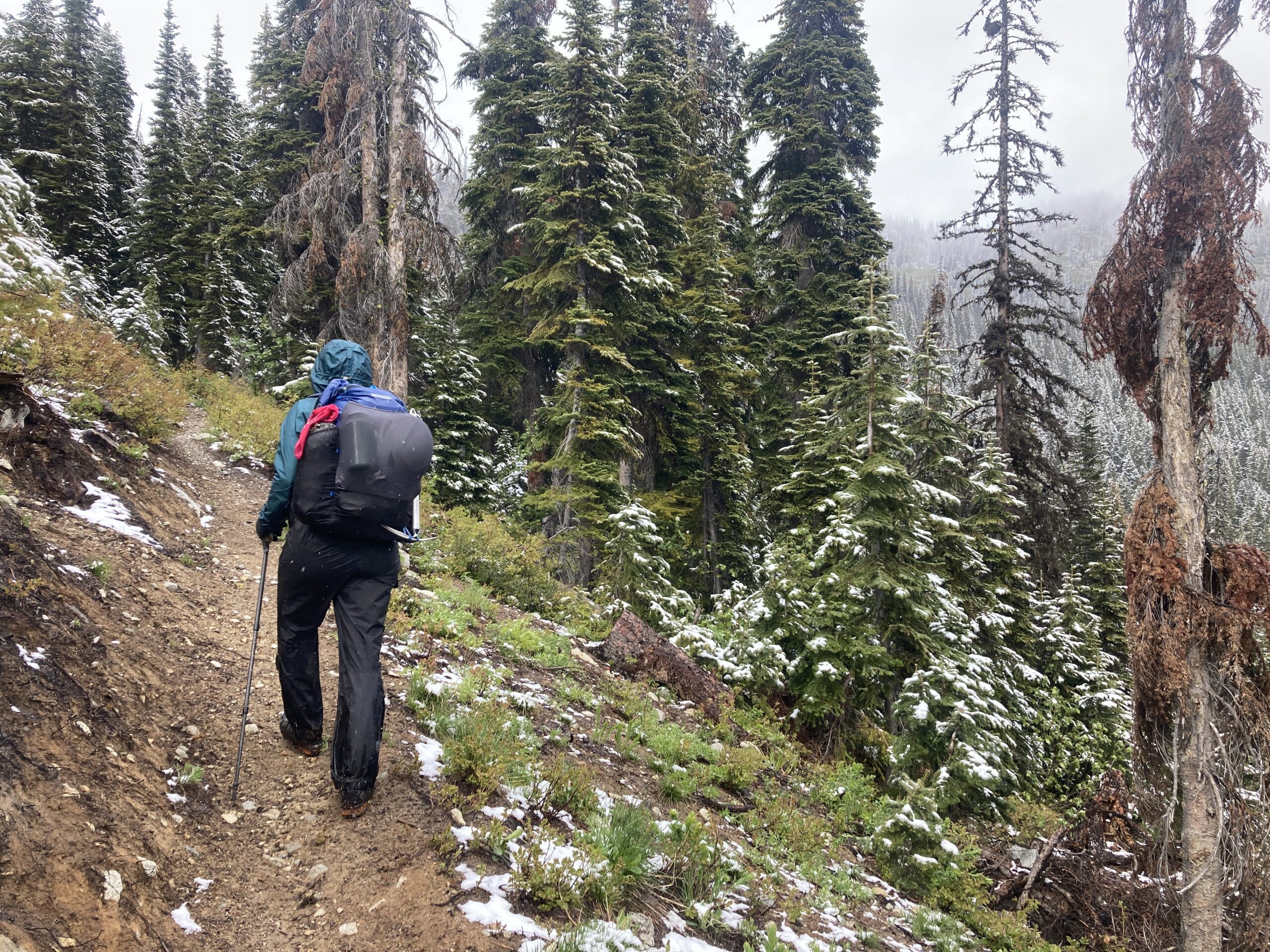
We took the boat the next morning on Lake Chelan to stehekin. We stopped at the bakery for amazing food (our favorites from the summer were the veggie and cheese croissants). We walked for a mile or so along the road past the bakery, and then headed up the Rainbow Falls trail, along Rainbow Creek. It was nice to walk on excellent trail! It started raining part way through our hike, and we got very cold and wet. Stopping just once to eat the Cinnamon Roll we had saved from the bakery. We intended to make it to the wilderness boundary that night to camp, just before the road. We didn’t quite make it, but set up a quick camp at Fireweed.
Day 6 – Hike to Bridge Creek and hitch a ride home
Early that morning we packed up and hiked out to the road. Still raining, we hoped for a ride the short distance back to our house! Someone picked us up after about 20 minutes of waiting. Grateful for the ride and to be out of the rain, he dropped us at our front door! Very cool to be able to end at home like that. What an eventful and interesting trip.